Skitouring Taghaube (Taghaubenscharte)

Logo Skitouring Taghaube (Taghaubenscharte)
Dati percorsi
2,89km
1.369 - 2.137m
Distanz
795hm
L'ascesa
02:30h
 
Durata
Descrizione rapida

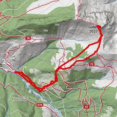
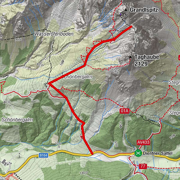
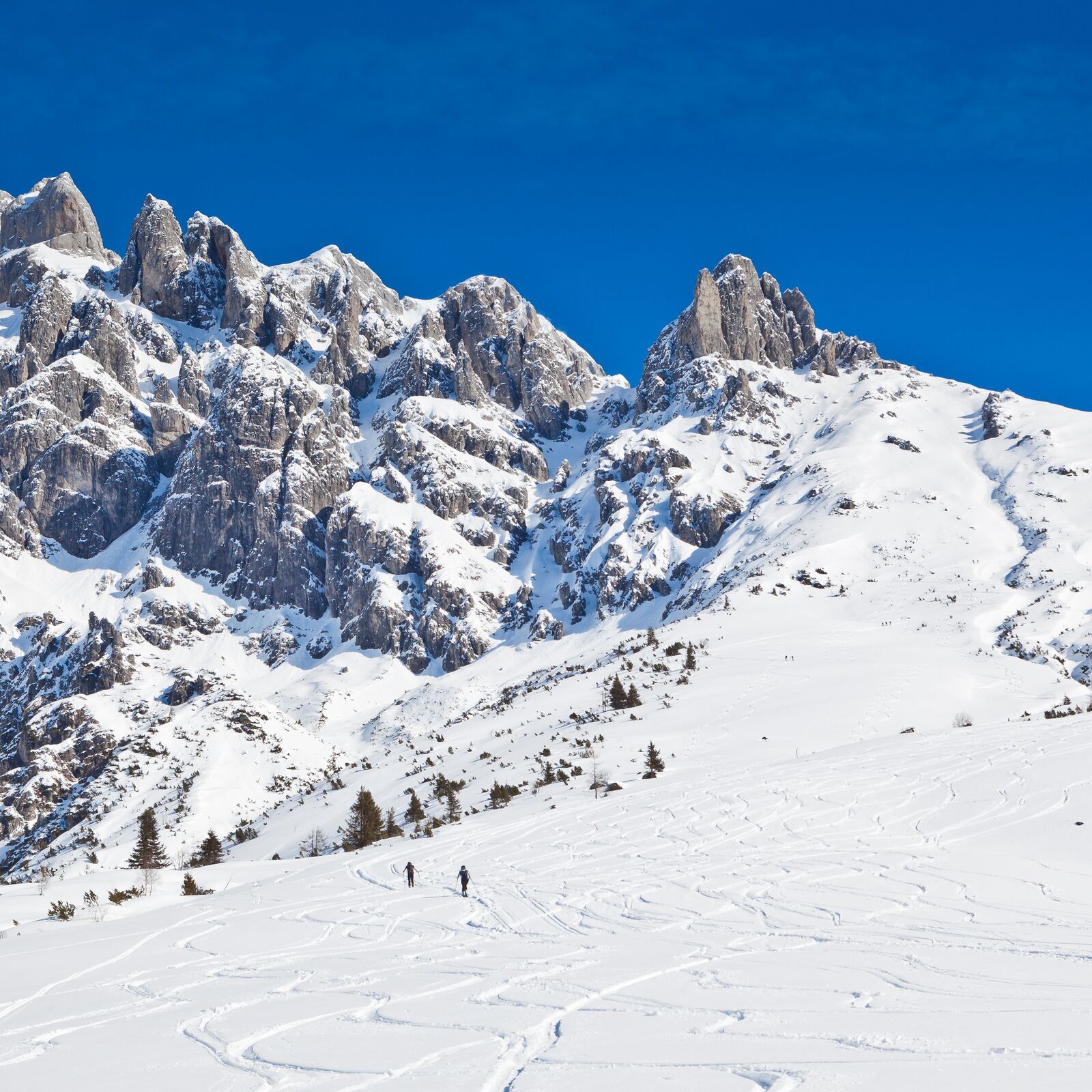
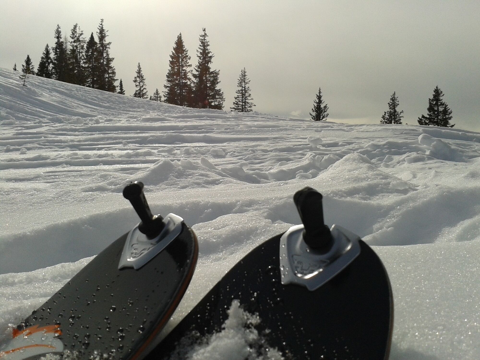
Moderately difficult tour in fantastic landscape. Slowly getting steeper and steeper towards the top, due to the southwest orientation the upper part of the tour is longer in the shade.

Difficoltà
intermedio
Valutazione
Tecnica
Forma fisica
Panorama
Avventura / Esperienza

La stagione migliore
ago
set
ott
nov
dic
gen
feb
mar
apr
mag
giu
lug
Punto più alto
2.137 m
Destinazione

Cleft between Grandlspitz and Taghaube

Exposition
Profilo altimetrico

Autore
Il tour Skitouring Taghaube (Taghaubenscharte) è utilizzato da outdooractive.com fornito.

4,0
Valutazione complessiva

5

0

%

4

100

%

3

0

%

2

0

%

1

0

%

GPS Downloads
  • GPX GPS Exchange Format (XML)
  • KML Google Earth, Google Maps
Codici di download QR per telefoni cellulari
Altri tour nelle regioni

Tour popolari della zona

Grossarl: Kitzstein (Gabel) (2,037 m)

intermedio Sciescursionismo
6,38km | 797hm | 03:30h

Skitouring educational trail Dienten

intermedio Sciescursionismo
4,37km | 659hm | 01:57h

Twiglight tour Aberg

intermedio Sciescursionismo
3,73km | 773hm | 02:45h

Jenner Skitour über Hochbahn

intermedio Sciescursionismo
14,55km | 1200hm | 04:30h