


Königslehen Circuit (SW21)


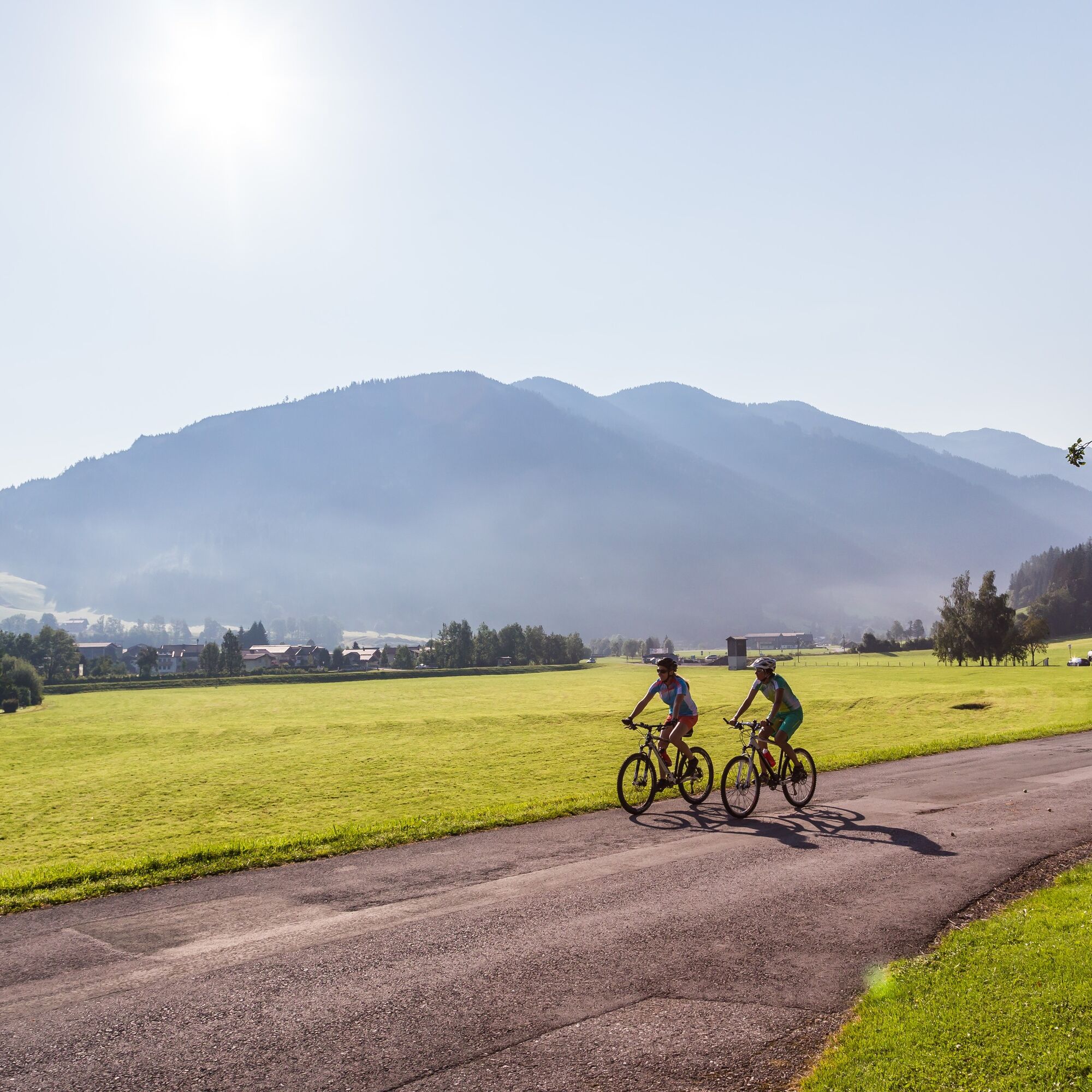
The Königslehen circuit has all the features that a varied cycle tour should offer. At the start, we take the leisurely, flat route along the edge of the forest and across the beautiful rural meadows and...
The Königslehen circuit has all the features that a varied cycle tour should offer. At the start, we take the leisurely, flat route along the edge of the forest and across the beautiful rural meadows and fields between Altenmarkt and Radstadt.
A worthwhile break is offered at the Berggasthof Bliembauer, where you can enjoy a marvellous view and regional delicacies on the sun terrace.
Key data of the tour:
Length: approx. 19 km Elevation gain: approx. 490 m Difficulty: medium
mountainbike, helmet
25% gravel, 75% asphalt road
Tauernautobahn A 10, Ausfahrt Altenmarkt (EXIT 63), Ausfahrt Altenmarkt West, entlang der Oberndorfer Straße, bei Kreuzung (BP Tankstelle) links weiter auf der Bundesstraße (B 163), nach 250 m rechts abbiegen zum Parkplatz gegenüber dem Tourismusverband Altenmarkt-Zauchensee
Mit dem Guest Mobility Ticket kannst du ab deiner Ankunft im SalzburgerLand alle öffentlichen Verkehrsmittel kostenlos nutzen.
Parkplatz gegenüber vom Tourismusverband Altenmarkt-Zauchensee
Tourist office Altenmarkt-Zauchensee
Sportplatzstraße 6
A-5541 Altenmarkt-Zauchensee
Tel: +43 6452 5511
E-Mail: info@altenmarkt-zauchensee.at
www.altenmarkt-zauchensee.at
www.facebook.com/altenmarkt-zauchensee
www.instagram.com/visitaltenmarktzauchensee
I tour più popolari nelle vicinanze
-
4,3
Filzmoos: Rötelstein (Rettenstein)
Escursionismo 9,50 km -
4,1
Reiteralm Höhen-Rundweg
medioEscursionismo 5,50 km -
4,8
Reiteralmrunde
luceEscursionismo 5,71 km -
4,2
Ennskraxn (2410m)
pesanteEscursionismo 14,7 km -
4,6
Escursione sciistica Lackenkogel
medioSciescursionismo 7,82 km -
5,0
Rundwanderweg von der Fallhausalm und Vögeialm übers Klamml zur Oberhütte am See
medioEscursionismo 10 km -
5,0
Forstau - Rippetegg / Reiteralm
medioEscursionismo 13,9 km -
4,4
Sci alpinismo Liebeseck
pesanteSciescursionismo 14,1 km -
3,6
Salzburger Gipfelspiel: al Gerzkopf e alle Schwarze Lacken
medioEscursionismo 8,39 km -
4,8
Obertauern alla cascata di Giovanni
medioEscursionismo 9,39 km
Escursioni e tracking


Non perdete le offerte e le ispirazioni per le vostre prossime vacanze
Il vostro indirizzo e-mail è stato aggiunto alla mailing list.