© Zell am See-Kaprun Tourismus GmbH - Birgit Arnold

© Zell am See-Kaprun Tourismus GmbH - Birgit Arnold

- Descrizione rapida
-
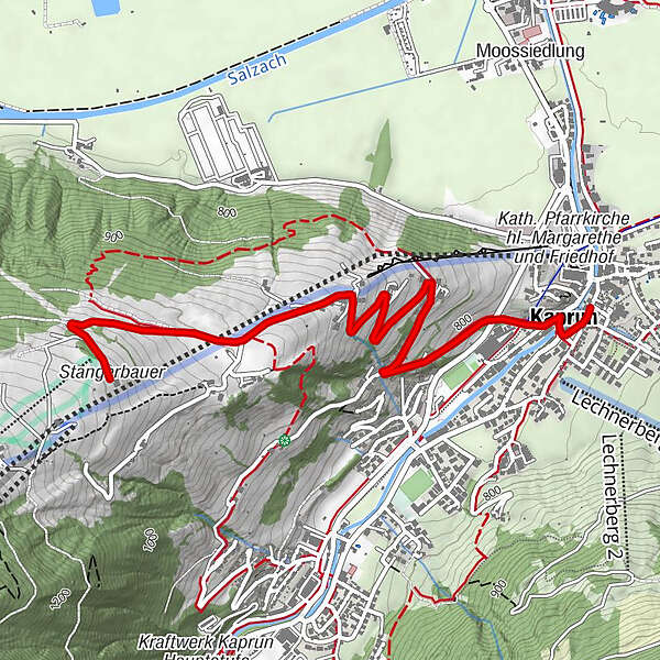
To the mountain restaurant Stangerbauer
- Difficoltà
-
facile
- Valutazione
-
- Percorso
-
Kaprun0,2 kmJausenstation Unteraigen1,4 kmGasthaus & Jausenstation Stangerbauer3,6 km
- La stagione migliore
-
genfebmaraprmaggiulugagosetottnovdic
- Punto più alto
- 1.092 m
- Destinazione
-
mountain restaurant Stangerbauer
- Profilo altimetrico
-


-

-
AutoreIl tour MTB tour to the Stangerbauer è utilizzato da outdooractive.com fornito.
GPS Downloads


Info generali
Punto di ristoro
Flora
Promettente
Altri tour nelle regioni