- Descrizione rapida
-
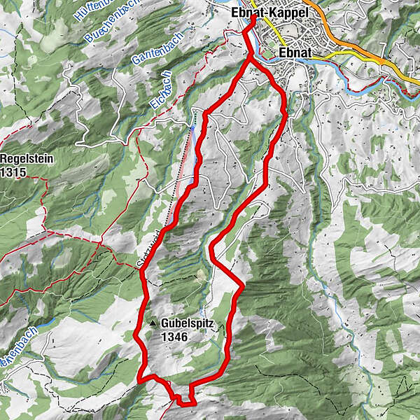
Technisch und konditionell mittlere Schneeschuhwanderung von Ebnat-Kappel zum Tanzboden und zurück mit reichlich Ausblick über das Toggenburg sowie auf den Zürichsee und auf die Glarner Alpen.
- Difficoltà
-
intermedio
- Valutazione
-
- Percorso
-
Ebnat-Kappel (630 m)KappelDicken1,8 kmHimmelstörli3,2 kmTanzboden (1.443 m)5,7 kmOber Abschlagen7,3 kmAbschlagenhöchi7,5 kmNestel8,3 kmBrand9,5 kmEbnat11,2 km
- La stagione migliore
-
agosetottnovdicgenfebmaraprmaggiulug
- Punto più alto
- 1.426 m
- Destinazione
-
Ebnat-Kappel
- Profilo altimetrico
-
 © outdooractive.com


- Autore
-
Il tour Schneeschuhwanderung zum Tanzboden è utilizzato da outdooractive.com fornito.
GPS Downloads


Info generali
Punto di ristoro
Promettente
Altri tour nelle regioni