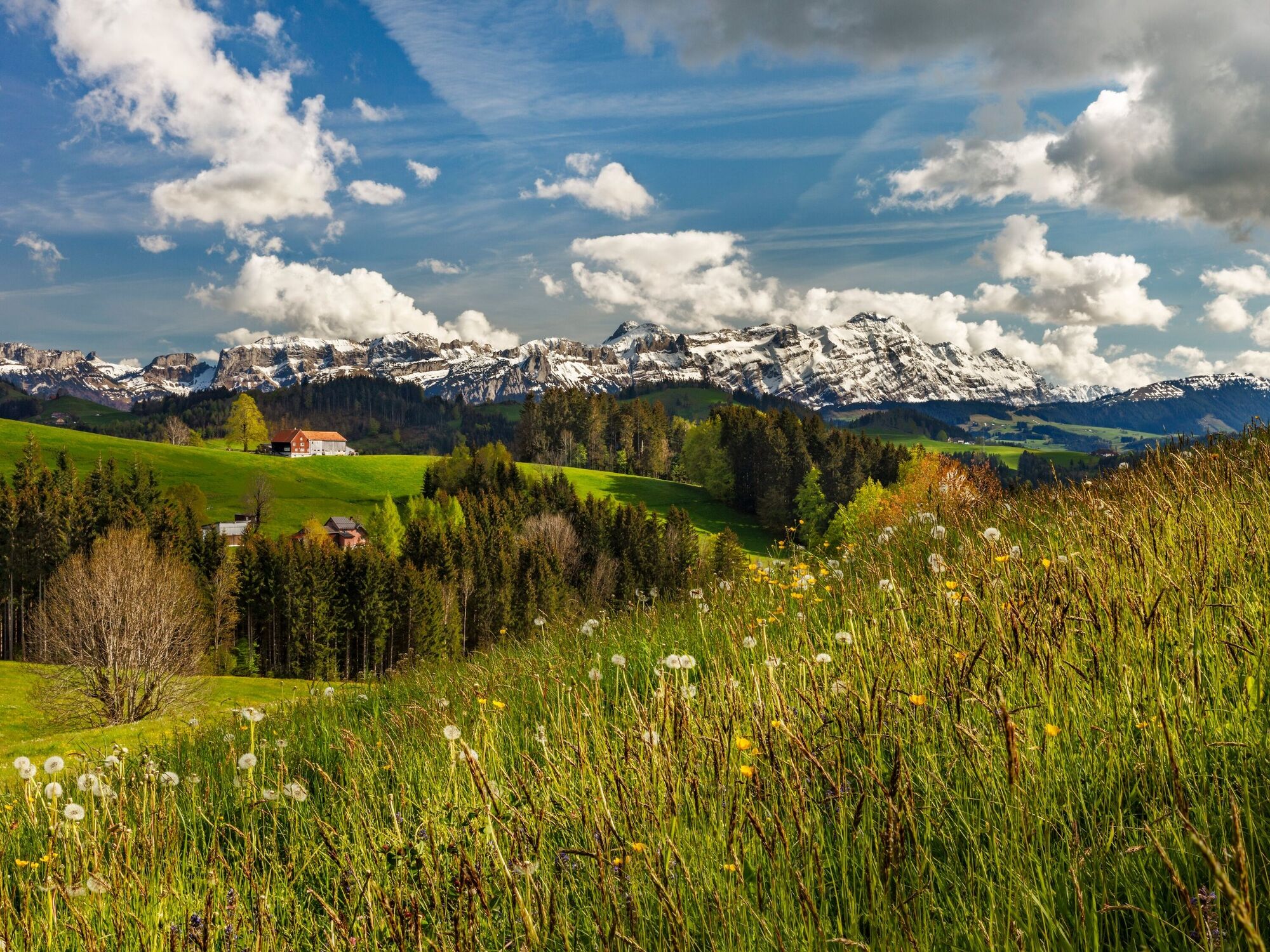
© Appenzellerland Tourismus AR - Corinne Kunz

© Appenzellerland Tourismus AR - René Niederer


- Descrizione rapida
-
On the Appenzeller vistas route you’ll pass both well-known and unknown highlights.
- Percorso
-
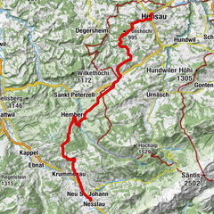
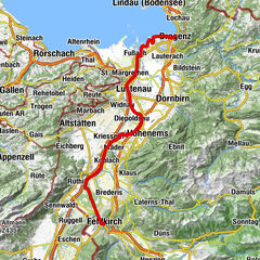
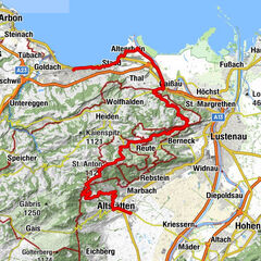
Heiden (794 m)0,0 kmHeiden0,8 kmOberegg (870 m)4,4 kmSt.Anton7,2 kmSt. Anton7,3 kmKapelle St. Anton7,3 kmSt. Anton7,5 kmSt. Anton (1.123 m)7,7 kmzum Wilden Mann8,5 kmGasthaus Landmark10,2 kmLandmark10,2 kmNeuschwendi (926 m)13,9 kmGasthaus zum Schäfli15,7 kmTrogen (903 m)15,7 kmTrogen15,9 kmBendlehn (932 m)17,3 kmSpeicher (924 m)17,7 kmTeufen AR22,1 kmGemsli22,1 kmSan Gallo (675 m)22,5 kmTeufen AR (837 m)22,8 kmZur Linde23,2 kmWallfahrtskirche Maria Hilf26,8 kmRestaurant Krone27,0 kmSchlatt-Haslen27,0 kmRestaurant Linde27,5 kmStöcken29,4 kmStein AR31,3 kmOchsen31,4 kmReformierte Kirche31,5 kmGasthaus Schäfli33,8 kmKapelle St. Wolfgang34,6 kmSt. Gallen Haggen (676 m)35,5 kmSt. Gallen Güterbahnhof37,6 kmSan Gallo (675 m)38,7 km
- La stagione migliore
-
genfebmaraprmaggiulugagosetottnovdic
- Punto più alto
- 1.108 m
- Destinazione
-
St. Gallen
- Profilo altimetrico
-
 © outdooractive.com


- Autore
-
Il tour Appenzeller vistas route è utilizzato da outdooractive.com fornito.
GPS Downloads


Info generali
Punto di ristoro
Promettente
Altri tour nelle regioni
-
St. Gallen - Bodensee
288
-
Appenzell Ausserrhoden
106
-
Speicher
44