
© Mende - Coeur de Lozère - Cyril Duclot

- Descrizione rapida
-
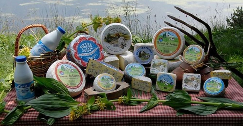
This tour in Margeride takes you to discover the local products of our department.All producers along this route will welcome you according to their availability.
- Valutazione
-
- Percorso
-
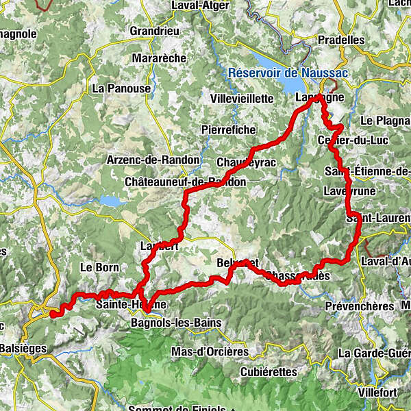
Mende0,1 kmChapelle des Pénitents Blancs0,1 kmL'Ozen5,6 kmBadaroux5,7 kmÉglise Saint-Christophe5,9 kmLes Salces12,7 kmLes Salelles17,6 kmAllenc20,3 kmLe Mazel21,8 kmL'Altaret23,4 kmLa Viale28,9 kmBelvezet29,6 kmChapelle Saint-Frézal30,4 kmLes Chazeaux30,5 kmSaint-Frézal-d'Albuges31,9 kmMirandol36,6 kmChasseradès38,1 kmÉglise Saint-Blaise38,1 kmMasméjean44,5 kmLes Huttes46,9 kmLes Huttes47,2 kmLa Bastide47,6 kmRogleton50,9 kmLaveyrune53,6 kmPranlac53,8 kmÉglise Saint-Pierre55,4 kmLuc55,9 kmLe Plo56,5 kmLa Maguelone57,6 kmLe Bouchâtel59,6 kmL'Estèvenès61,2 kmBrugeyrolles65,9 kmLangogne68,6 kmChâteau Barres71,5 kmChaudeyrac80,2 kmGrand Connétable87,4 kmL'Habitarelle87,6 kmGourgons92,1 kmLaubert96,1 kmPelouse98,8 kmLes Salces102,5 kmÉglise Saint-Christophe109,4 kmBadaroux109,4 kmL'Ozen109,7 kmMende115,2 km
- La stagione migliore
-
genfebmaraprmaggiulugagosetottnovdic
- Punto più alto
- 1.265 m
- Destinazione
-
Mende
- Profilo altimetrico
-
 © outdooractive.com
-

-
AutoreIl tour Gourmet itinerary: the wide open spaces of Margeride è utilizzato da outdooractive.com fornito.
GPS Downloads


Info generali
Punto di ristoro
Culturale/Storico
Promettente