

© TV Nationalpark Region Steyrtal

- Descrizione rapida
-
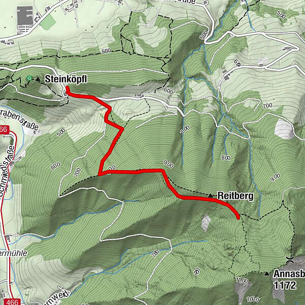
Hike to the Reitberg and Toif Meadow
- Difficoltà
-
intermedio
- Valutazione
-
- Percorso
-
Reitberg2,1 km
- La stagione migliore
-
genfebmaraprmaggiulugagosetottnovdic
- Punto più alto
- 996 m
- Destinazione
-
Molln/Toif
- Profilo altimetrico
-


- Autore
-
Il tour Toif am Annasberg è utilizzato da outdooractive.com fornito.
GPS Downloads


Info generali
Flora
Altri tour nelle regioni
-
Traunviertel
1942
-
Steyr und die Nationalpark Region
1373
-
Molln
376


