
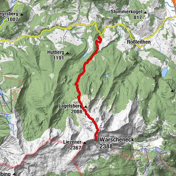
Dati percorsi
8,6km
767
- 2.375m
1.616hm
1.616hm
03:25h
- Difficoltà
-
intermedio
- Valutazione
-
- Percorso
-
Zellerhütte4,7 kmWarscheneck (2.388 m)8,5 km
- La stagione migliore
-
genfebmaraprmaggiulugagosetottnovdic
- Punto più alto
- 2.375 m
GPS Downloads


Condizioni dei sentieri
Asfalto
Ghiaia
Prato
Foresta
Roccia
Esposta
Altri tour nelle regioni
-
Traunviertel
1940
-
Urlaubsregion Pyhrn - Priel
1440
-
Vorderstoder
438


