© Sulzbacher
Dati percorsi
6,72km
587
- 2.088m
1.480hm
10:00h
- Descrizione rapida
-
Schwierigkeitsgrad: Schwarz - alpiner Steig
- Valutazione
-
- Punto di partenza
-
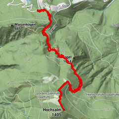
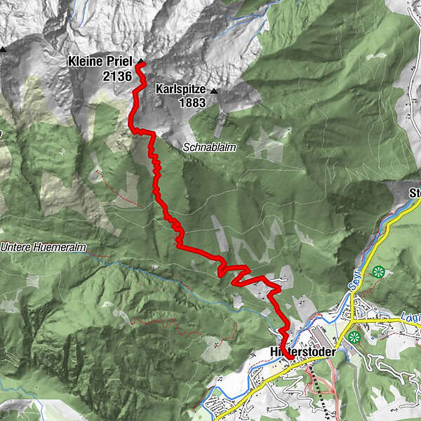
Hinterstoder Ortszentrum
- Percorso
-
HinterstoderKessenspitz (1.810 m)5,7 kmKleiner Priel (2.136 m)6,6 km
- Punto più alto
- 2.088 m
- Riposo/Ritiro
-
Gastronomie in Hinterstoder
- Cartine
-
Wanderkarte Pyhrn-Priel erhältlich in allen Pyhrn-Priel Tourismusbüros!

GPS Downloads


Condizioni dei sentieri
Asfalto
Ghiaia
Prato
Foresta
Roccia
Esposta
Altri tour nelle regioni
-
Traunviertel
1940
-
Urlaubsregion Pyhrn - Priel
1440
-
Hinterstoder
395