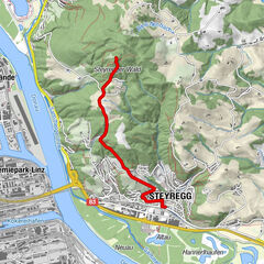
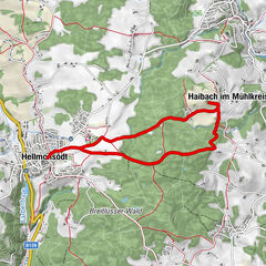
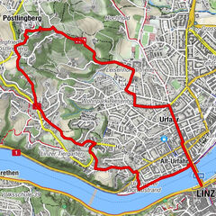
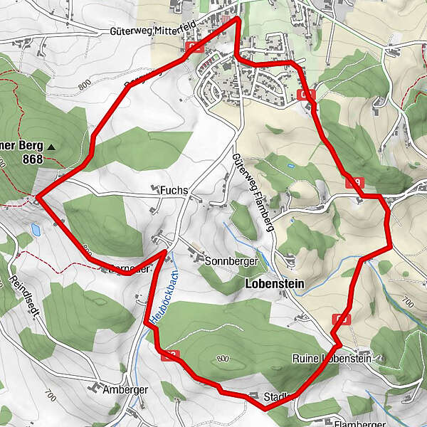
Oberneukirchen - Lobensteinrunde O2

Logo Oberneukirchen - Lobensteinrunde O2
Dati percorsi
7,26km
710 - 838m
Distanz
188hm
189hm
L'ascesa
02:00h
 
Durata
Difficoltà
facile
Valutazione
Tecnica
Forma fisica
Panorama
Avventura / Esperienza
Percorso
Oberneukirchen
Lobenstein
2,4 km
Oberneukirchen
6,9 km

La stagione migliore
gen
feb
mar
apr
mag
giu
lug
ago
set
ott
nov
dic
Punto più alto
838 m

2,5
Valutazione complessiva

5

0

%

4

0

%

3

50

%

2

50

%

1

0

%

GPS Downloads
  • GPX GPS Exchange Format (XML)
  • KML Google Earth, Google Maps
Codici di download QR per telefoni cellulari

Condizioni dei sentieri

Asfalto
Ghiaia
Prato
Foresta
Roccia
Esposta

Tour popolari della zona

Steyregg Pfenningberg-Gipfelwanderweg

intermedio Escursionismo
4km | 316hm | 01:30h

Leonding: Turmwanderung

facile Escursionismo
7,67km | 119hm | 02:10h

SternGartl Blick lookout tower R4

intermedio Escursionismo
7,75km | 113hm | 02:12h

Linz: Pöstlingberg Town Hiking Trail

intermedio Escursionismo
7,71km | 241hm | 02:50h