© brainpark.traunsee

© brainpark.traunsee

© brainpark.traunsee

© Andreas Röbl

- Descrizione rapida
-
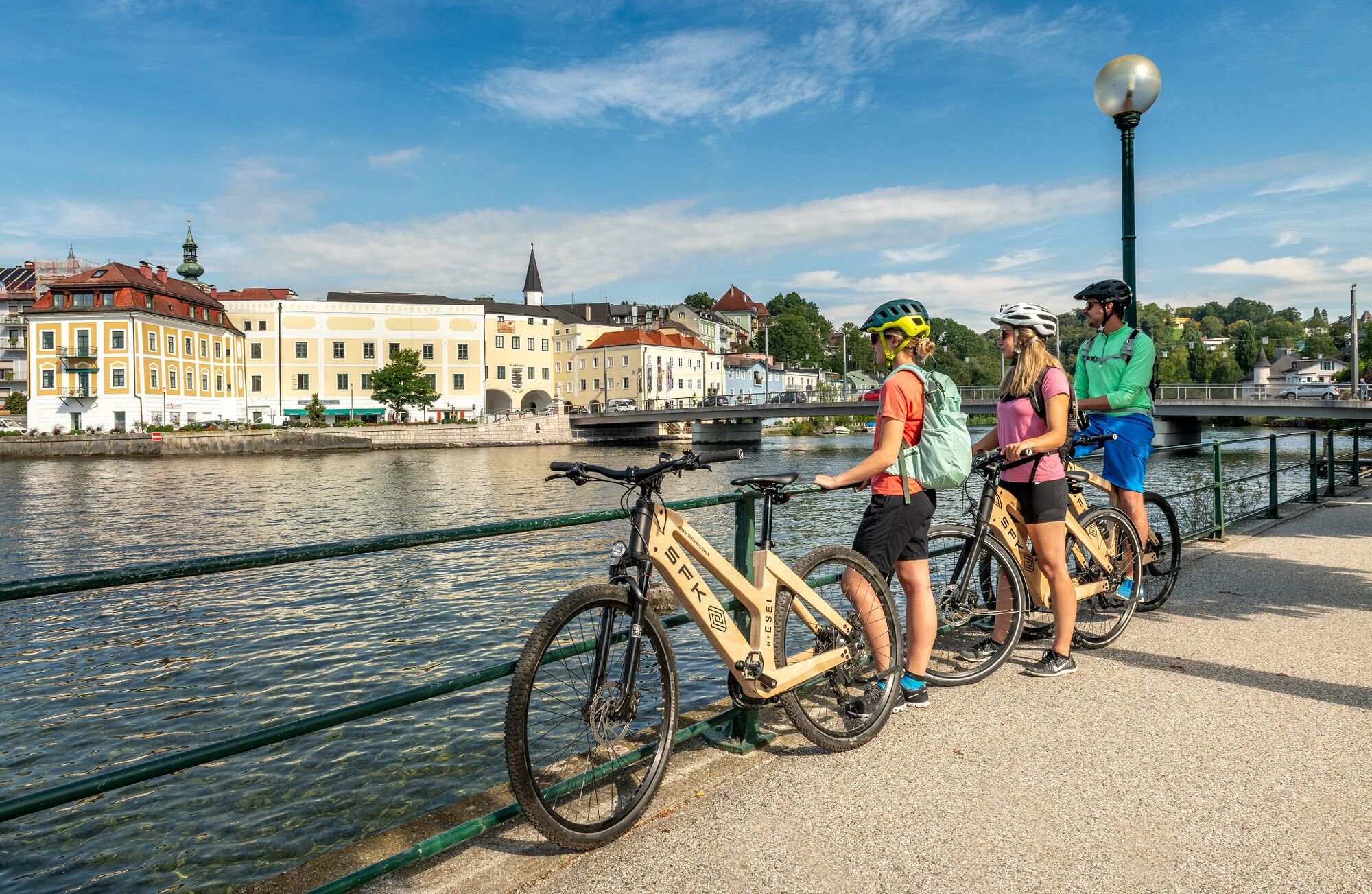
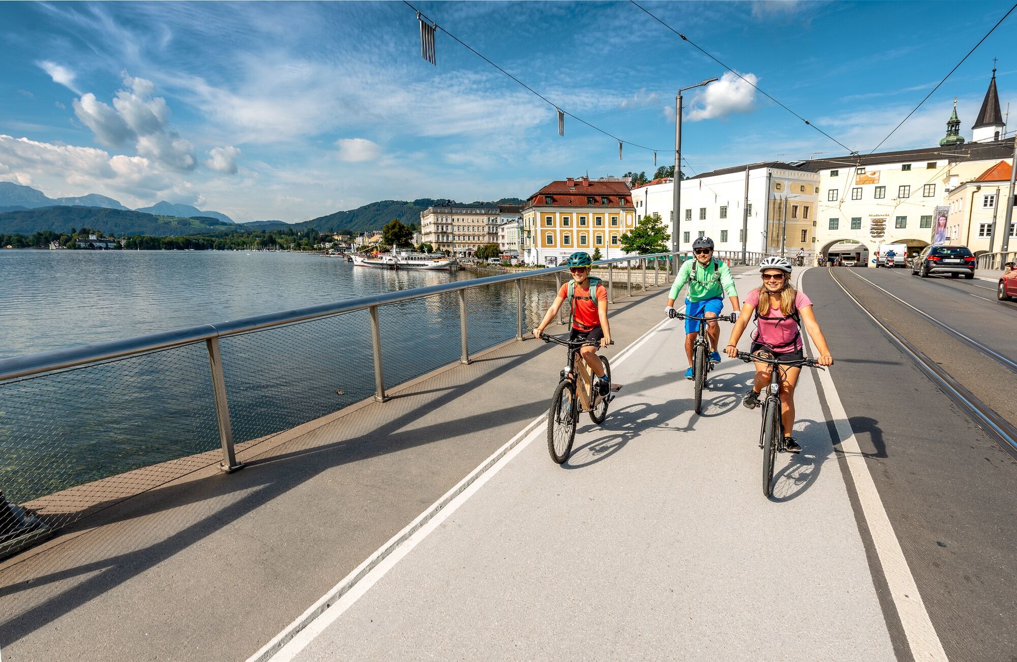
E-bike pleasure tour in 7 daily stages over approx. 460 kilometres and approx. 5,000 meters of altitude!
An enjoyable cycling holiday trip!
Perfect for those who are planning a cycling holiday on their own doorstep: A new e-bike pleasure tour leads in six to seven daily stages over a length of approx. 462 kilometres and approx. 5,000 metres of altitude from/to Steyr.
On the way, you will be able to explore the regional, cultural and culinary highlights at your own pace along rivers and waters.
- Difficoltà
-
intermedio
- Valutazione
-
- Percorso
-
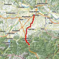
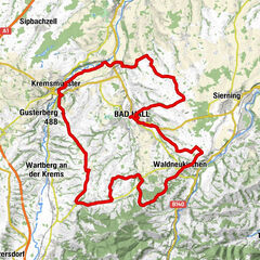
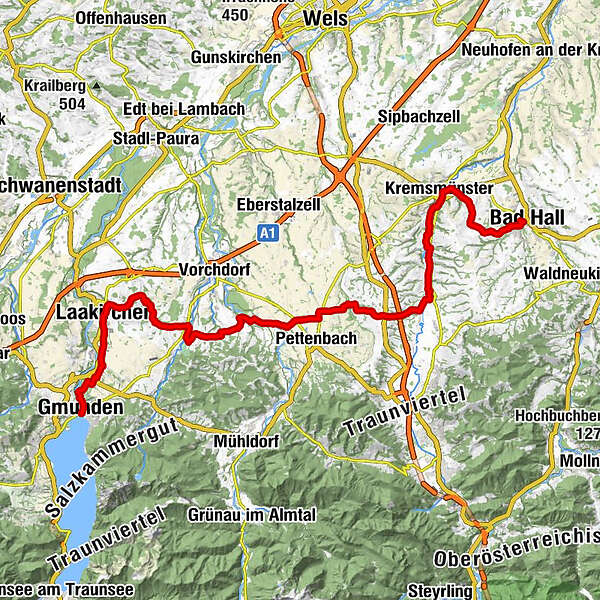
Gmunden (425 m)Oberweis5,5 kmKapelle5,6 kmOberweis5,8 kmPizza House5,8 kmSchweigthal6,5 kmGasthof Wirt am Bach6,8 kmKapelle6,9 kmPfarrkirche Laakirchen9,4 kmLaakirchen9,5 kmWeikharting12,4 kmDiethaming13,2 kmÖlling15,0 kmGH Bauer17,8 kmGH Pöll18,0 kmKirchham18,1 kmLaudachtal18,1 kmIm Tal18,4 kmLaizing18,6 kmSteg18,9 kmWindberg19,2 kmZwergerlwald19,2 kmHeitzing22,4 kmAggsbach23,0 kmFilialkirche Einsiedling24,1 kmEggenstein25,6 kmPfaffing28,0 kmGasthaus Hemetmair28,1 kmGasthaus Neuhauser40,2 kmWartberg an der Krems40,2 kmPizzerria Margarita40,6 kmOberburgfried48,2 kmKremsmünster49,0 kmDehenwang53,5 kmFeyregg55,9 kmPfarrkirchen bei Bad Hall56,6 kmMargarethenkapelle57,6 kmBad Hall57,6 kmPfarrkirche Bad Hall57,7 km
- La stagione migliore
-
genfebmaraprmaggiulugagosetottnovdic
- Punto più alto
- 543 m
- Destinazione
-
Bad Hall
- Profilo altimetrico
-


- Autore
-
Il tour Traunviertel Tour - Stage 3 è utilizzato da outdooractive.com fornito.
GPS Downloads


Altri tour nelle regioni