

Dati percorsi
15,86km
5
- 11m
32hm
29hm
03:23h
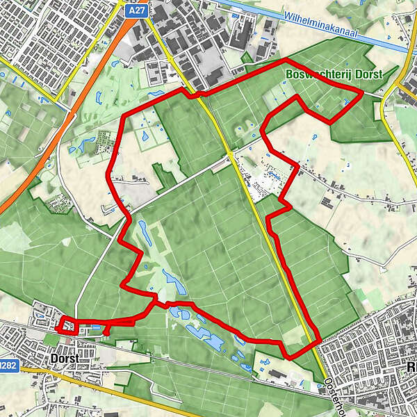
- Difficoltà
-
facile
- Valutazione
-
- Percorso
-
Dorst0,1 kmMariakapel0,3 kmRijen3,6 kmDongen8,3 kmOosterhout10,6 kmSeters12,1 kmBeum14,9 kmMariakapel15,5 km
- Punto più alto
- 11 m