

© ZWalk.at

© ZWalk.at

© ZWalk.at
Dati percorsi
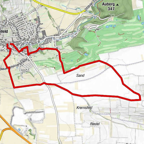
6,47km
300
- 367m
88hm
82hm
02:00h
- Descrizione rapida
-
Die Tour führt durch eine typische, leicht hügelige Waldviertler Landschaft. Es geht durch Felder, Wiesen und Wälder, die sich ständig abwechseln.
- Difficoltà
-
facile
- Valutazione
-
- Punto di partenza
-
Lengenfeld
- Percorso
-
Gasthaus AnderlLengenfeldKath. Pfarrkirche hl. Pankratius6,0 kmGasthaus Anderl6,3 kmLengenfeld6,3 km
- Punto più alto
- 367 m


- Fonte
- ZWalk
GPS Downloads


Altri tour nelle regioni
-
Donau Niederösterreich
2288
-
Kamptal - Manhartsberg
1158
-
Lengenfeld
549


