ZWalk - Sprögnitz - Der Sonnentor Kräuterwanderweg

Logo ZWalk - Sprögnitz - Der Sonnentor Kräuterwanderweg
Dati percorsi
6,68km
704 - 774m
Distanz
71hm
L'ascesa
02:00h
 
Durata
Descrizione rapida

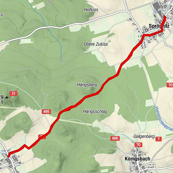
Die Tour führt durch eine typische, leicht hügelige Waldviertler Landschaft. Es geht durch Felder, Wiesen und Wälder, die sich ständig abwechseln.

Difficoltà
facile
Valutazione
Tecnica
Forma fisica
Panorama
Avventura / Esperienza
Punto di partenza

Sprögnitz

Percorso
Sprögnitz
0,3 km
Aubergfeld
2,5 km
Engelbrechts
3,3 km
Sprögnitz
6,3 km


Punto più alto
774 m

Fonte
ZWalk

Valutazione complessiva

5

0

%

4

0

%

3

0

%

2

0

%

1

0

%

Errore
Si è verificato un errore. Si prega di riprovare.
Grazie per la vostra recensione

La valutazione è stata cancellata

GPS Downloads
  • GPX GPS Exchange Format (XML)
  • KML Google Earth, Google Maps
Codici di download QR per telefoni cellulari

Condizioni dei sentieri

Asfalto
Ghiaia
Prato
Foresta
Roccia
Esposta
Altri tour nelle regioni

Tour popolari della zona

Wine hiking trail Spitz

facile Escursionismo
4,32km | 140hm | 01:30h

Rossatz Seekopf Rotes Kreuz Seegraben retour 21.04.2017

facile Escursionismo
15km | 665hm | 05:00h

Wine autumn in Spitz on the Danube

intermedio Escursionismo
7,5km | 281hm | 02:20h

Panoramaweg Spitzer Graben

intermedio Escursionismo
18,56km | 630hm | 06:20h