© ZWalk.at

© ZWalk.at

© ZWalk.at
Dati percorsi
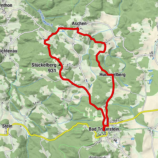
10,19km
816
- 918m
165hm
02:30h
- Descrizione rapida
-
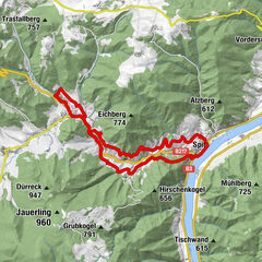
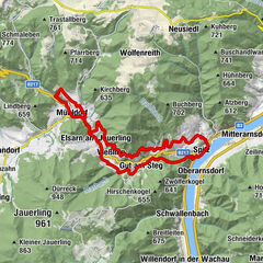
Die Tour führt durch eine typische, leicht hügelige Waldviertler Landschaft. Es geht durch Felder, Wiesen und Wälder, die sich ständig abwechseln.
- Difficoltà
-
facile
- Valutazione
-
- Punto di partenza
-
Bad Traunstein
- Percorso
-
Bad TraunsteinSpitzhof0,8 kmHummelberg1,7 kmMaueröd3,3 kmAschen4,6 kmNester5,6 kmBankschmitten5,8 kmStückelberg (932 m)7,1 kmSchönau8,1 kmBad Traunstein10,1 km
- Punto più alto
- 918 m


- Fonte
- ZWalk
GPS Downloads


Condizioni dei sentieri
Asfalto
Ghiaia
Prato
Foresta
Roccia
Esposta
Altri tour nelle regioni
-
Waldviertel
1776
-
Südliches Waldviertel
936
-
Bad Traunstein
273