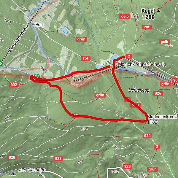
Dati percorsi
4,47km
1.170
- 1.350m
178hm
01:30h
- Valutazione
-
- Punto di partenza
-
Mönichkirchner Schwaig
- Percorso
-
Berggasthof Mönichkirchner Schwaig0,2 kmHallerhaus3,2 km
- Punto più alto
- 1.350 m
- Riposo/Ritiro
-
Gasthaus Enzian oder Gasthaus Stern auf der Mönichkirchner Schwaig, oder Hallerhaus
- Cartine
-
Berg- oder Talstation Sessellift, Gemeindeamt.
GPS Downloads


Condizioni dei sentieri
Asfalto
Ghiaia
Prato
Foresta
Roccia
Esposta
Altri tour nelle regioni
-
Wiener Alpen
3048
-
Wechselland - Wiener Alpen
1704
-
Mönichkirchen
358
")