© © Waldviertel Tourismus, Reinhard Mandl - Destination Waldviertel

- Descrizione rapida
-
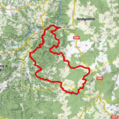
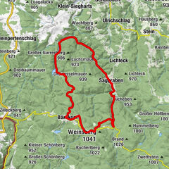
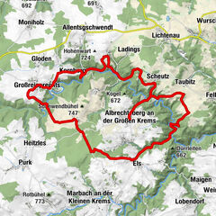
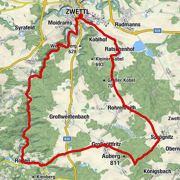
Zwettl - Gschwendtmühle - Roiten - Frankenreith - Großgöttfritz - Rohrenreith - Ratschenhof - Zwettl
- Difficoltà
-
facile
- Valutazione
-
- Percorso
-
Zwettl0,1 kmJohannes-Nepomuk-Kapelle0,2 kmBründlkirche1,0 kmMühlfeld7,8 kmSatzling11,8 kmRoiten12,4 kmGasthaus König12,4 kmStampfwiesen13,1 kmFrankenreith15,1 kmGasthaus Schrammel15,3 kmGroßgöttfritz17,7 kmGasthaus Robert Maier17,7 kmMaier Heuriger17,7 kmSprögnitz21,8 kmRohrenreith24,8 kmKirchbühel (720 m)25,5 kmRatschenhof28,4 kmJohannes-Nepomuk-Kapelle31,5 kmZwettl31,7 km
- La stagione migliore
-
genfebmaraprmaggiulugagosetottnovdic
- Punto più alto
- 771 m
- Destinazione
-
Zwettl
- Profilo altimetrico
-

- Autore
-
Il tour Hundertwasser-Tour è utilizzato da outdooractive.com fornito.
GPS Downloads


Info generali
Culturale/Storico
Altri tour nelle regioni
-
Waldviertel
169
-
Waldviertel Mitte
101
-
Großgöttfritz
23