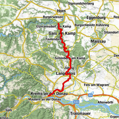
Danube Cycle Path, stage 5, north bank: Emmersdorf - Krems


- Descrizione rapida
-
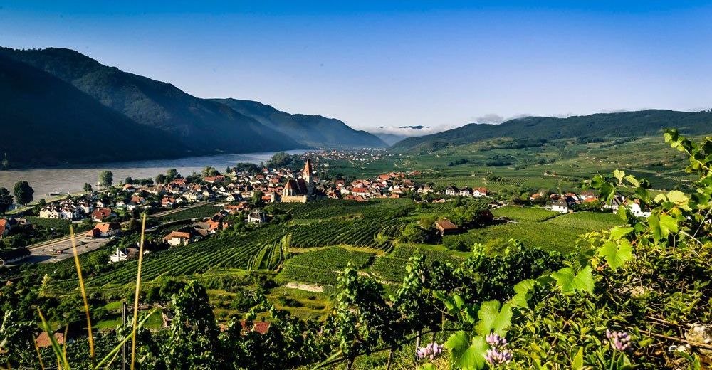
Through the enchanted garden to a romantic landscape
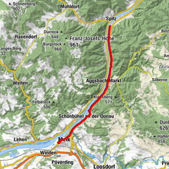
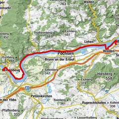
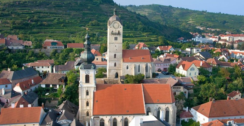
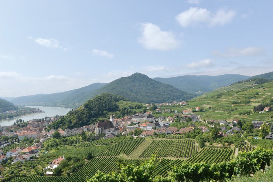
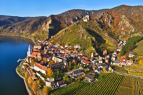
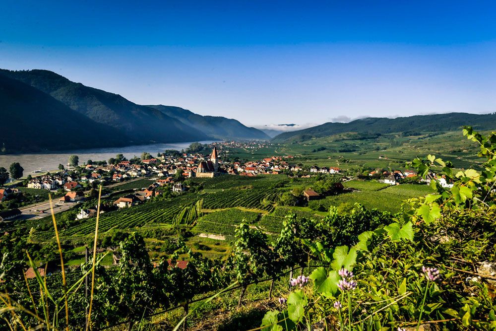
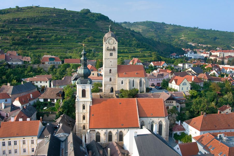
The tour takes you via the Danube Bike Path from the Danube town of Emmersdorf through the Wachau, a landscape shaped by human hand, and beyond to Krems, a statutory city on the Danube, i.e. it has the authority of both a city and a district. On your ride through the Wachau, a UNESCO World Heritage landscape, you pass through Aggsbach, Spitz and Weissenkirchen, among other towns, before arriving at your destination: Krems, a center of commerce and culture.
IMPORTANT NOTE:
From February 2020 until the end of 2021, the Danube Cycle Trail will be diverted in the Höhe Ringstraße area of Krems, due to necessary pipeline works. Please follow the diversion signposts in the Krems city area.
Due to construction works on the bridge between Mautern and Stein (the Mauterner Brücke), there will be restrictions for cyclists, starting immediately! We recommend allowing enough time to cross the Danube elsewhere.
- Difficoltà
-
intermedio
- Valutazione
-
- Percorso
-
Magdalenenkapelle0,1 kmHotel & Restaurant Donauhof0,1 kmEmmersdorf an der Donau0,2 kmSchallemmersdorf1,7 kmWeissis Gaststubn2,4 kmGrimsing3,1 kmAggsbach Markt7,6 kmGasthof-Pension Zum Kranz7,7 kmGroisbach10,4 kmWillendorf in der Wachau11,1 kmRudis Heuriger11,2 kmGasthof zur Venus11,2 kmSchwallenbach12,5 kmFilialkirche hl. Sigismund12,9 kmOberarnsdorf14,3 kmSpitz15,7 kmSpitz a.d. Donau16,3 kmFelsdach16,9 kmMarterlhöhle17,0 kmMitterarnsdorf17,6 kmWehrkirche St. Michael17,9 kmSankt Michael18,0 kmPfarrkirche Wösendorf19,5 kmWösendorf in der Wachau19,6 kmJoching20,5 kmWeißenkirchen21,8 kmPfarrkirche Weißenkirchen22,2 kmDürnstein27,3 kmKunigunden Kirche27,6 kmKarner27,6 kmOberloiben28,8 kmPfarrkirche Unterloiben29,3 kmUnterloiben29,3 kmRothenhof30,7 kmSt. Matthias31,7 kmFörthof31,9 kmStein-Mautern32,1 kmStein an der Donau32,9 kmKrems an der Donau34,0 km
- La stagione migliore
-
genfebmaraprmaggiulugagosetottnovdic
- Punto più alto
- 223 m
- Destinazione
-
Krems
- Profilo altimetrico
-

- Autore
-
Il tour Danube Cycle Path, stage 5, north bank: Emmersdorf - Krems è utilizzato da outdooractive.com fornito.