Durch die Herrschaft Buonas (Ausflug in die Vergangenheit)

Sentiero tematico
- Percorso
-
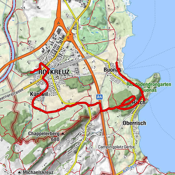
Buonas (429 m)0,2 kmRestaurant Wildenmann0,2 kmSt. German0,4 kmKatholische Kirche St. Verena1,6 kmRisch (440 m)1,9 kmKirchberg3,0 kmBrüglen4,2 kmBreitfeld4,9 kmLandgasthof Breitfeld5,1 kmKapelle Berchtwil5,5 kmIbikon5,7 kmSteintobel6,1 kmBachtalen6,6 kmKüntwil7,3 kmRotkreuz (430 m)8,2 kmAllrüti8,5 kmBinzmühle9,1 km
- Punto più alto
- 525 m
- Profilo altimetrico
-
 © outdooractive.com
- Autore
-
Il tour Durch die Herrschaft Buonas (Ausflug in die Vergangenheit) è utilizzato da outdooractive.com fornito.
GPS Downloads


Altri tour nelle regioni
-
Luzern und Umgebung
1711
-
Hohlgassland
901
-
Meierskappel
212