- Descrizione rapida
-
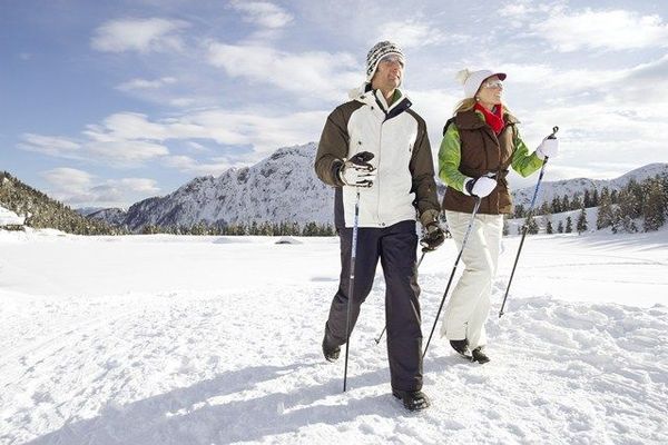
Nature lovers, who need a few hours for themselves, find new serenity during winter hiking
- Difficoltà
-
facile
- Valutazione
-
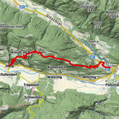
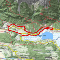
- Percorso
-
TröpolachTröpolach4,4 kmPfarrkirche Tröpolach4,5 km
- La stagione migliore
-
agosetottnovdicgenfebmaraprmaggiulug
- Punto più alto
- 617 m
- Destinazione
-
Tröpolach
- Profilo altimetrico
-


- Autore
-
Il tour Rundweg Tröpolach è utilizzato da outdooractive.com fornito.
GPS Downloads


Altri tour nelle regioni