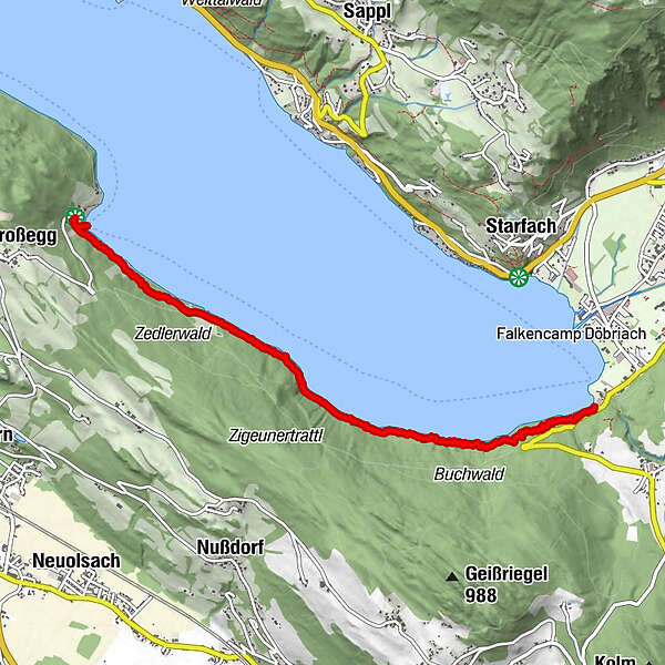
Dati percorsi
6,08km
597 - 627m
Distanz
87hm
67hm
L'ascesa
01:33h
 
Durata
Descrizione rapida

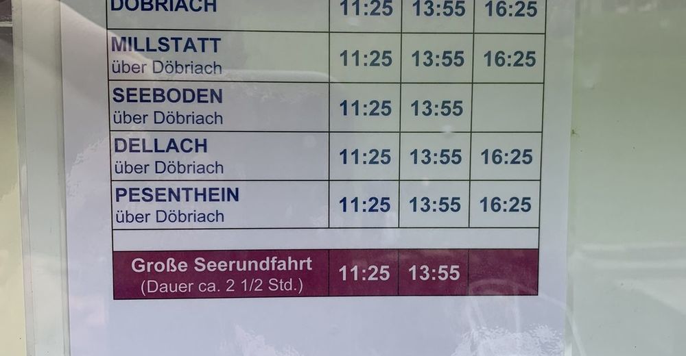
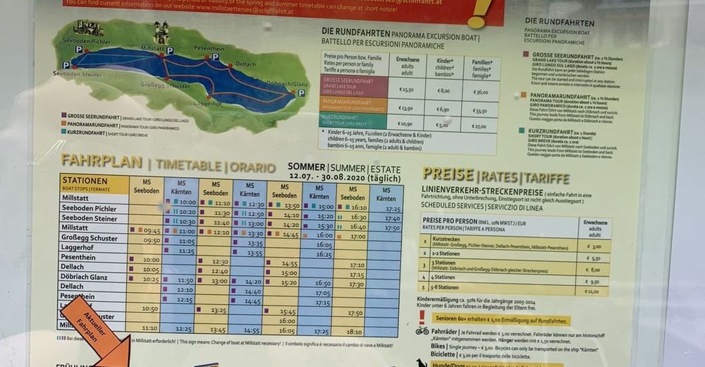
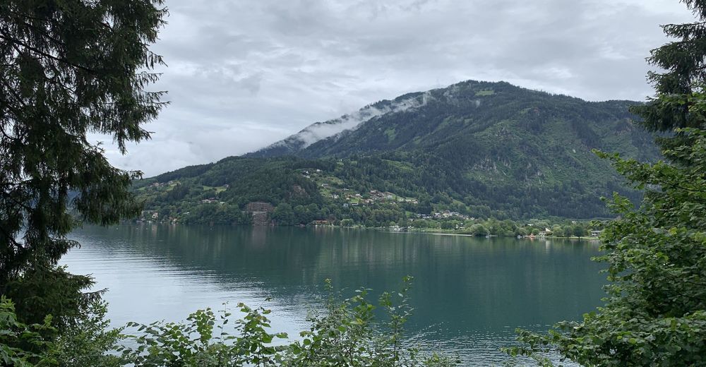
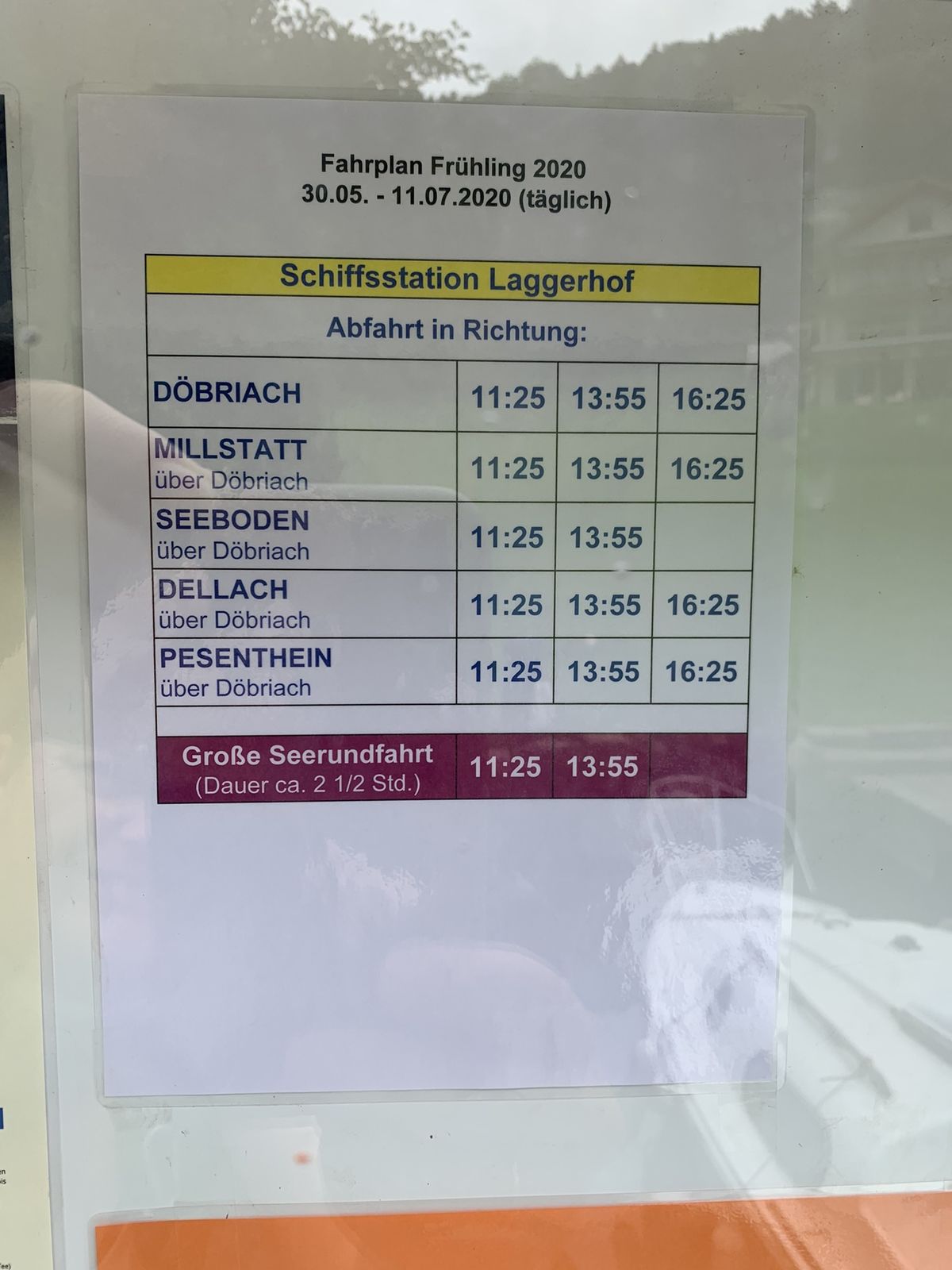
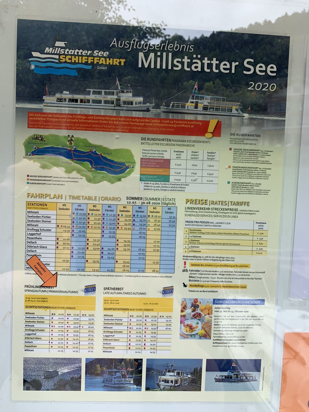
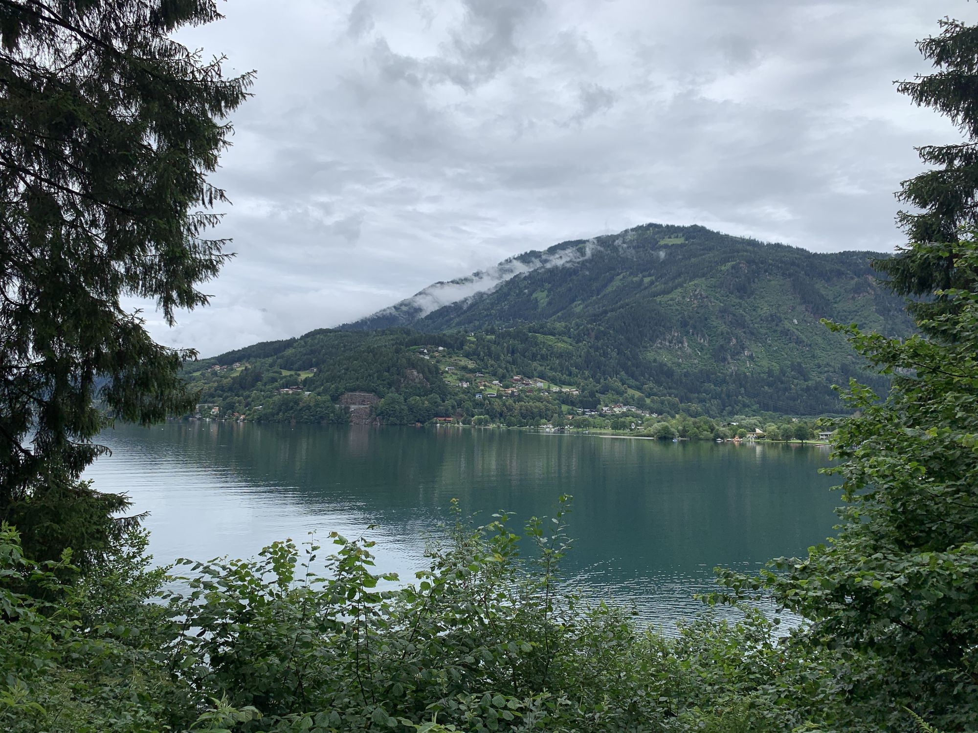
Dry easy walking along the lake, ending at a restaurant. Walk back or take the ship.

Difficoltà
facile
Valutazione
Tecnica
Forma fisica
Panorama
Avventura / Esperienza
Percorso
Großegg
5,8 km
Laggerhof
5,9 km
Gasthof Laggerhof
6,0 km

La stagione migliore
gen
feb
mar
apr
mag
giu
lug
ago
set
ott
nov
dic
Punto più alto
627 m

Valutazione complessiva

5

0

%

4

0

%

3

0

%

2

0

%

1

0

%

Errore
Si è verificato un errore. Si prega di riprovare.
Grazie per la vostra recensione

La valutazione è stata cancellata

GPS Downloads
  • GPX GPS Exchange Format (XML)
  • KML Google Earth, Google Maps
Codici di download QR per telefoni cellulari

Tour popolari della zona

Tschiernock - Millstätter Alpe

facile Escursionismo
14,01km | 513hm | 04:00h

Sonnwiesenrundweg

intermedio Escursionismo
4,67km | 230hm | 01:40h

Bergfriedhütte - Gmeineck

intermedio Escursionismo
7,41km | 784hm | 03:13h

Staff

intermedio Escursionismo
6,35km | 782hm | 05:00h