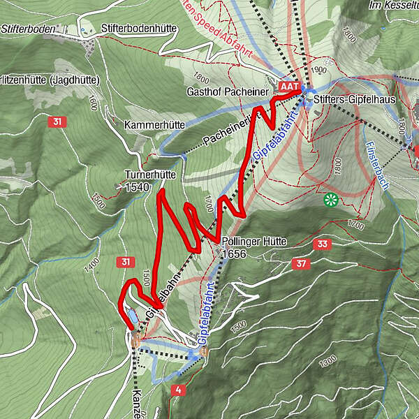
Gerlitzen (von der Kanzelhöhe auf den Gipfel)

Escursionismo
Dati percorsi
8,3km
1.442
- 1.911m
451hm
451hm
01:00h
- Descrizione rapida
-
Von der Kanzelhöhe auf den Gipfel und mit der Bahn ins Tal
- Difficoltà
-
intermedio
- Valutazione
-
- Punto di partenza
-
Parkplatz der Kanzelbahn
- Percorso
-
Alpengasthof Pacheiner3,9 kmPlayground Pacheiner4,0 kmGerlitzen (1.909 m)4,1 km
- La stagione migliore
-
genfebmaraprmaggiulugagosetottnovdic
- Punto più alto
- Gerlitzen (1.911 m)
- Destinazione
-
Gipfel
- Riposo/Ritiro
-
Alpfengasthof Pachheiner
GPS Downloads


Condizioni dei sentieri
Asfalto
Ghiaia
Prato
Foresta
Roccia
Esposta
Altri tour nelle regioni