© Region Villach - Faaker See - Ossiacher See - Gert Perauer

© Region Villach - Faaker See - Ossiacher See - Gert Perauer

© Region Villach - Faaker See - Ossiacher See - Gert Perauer

© Gert Perauer - Region Villach

© Region Villach - Faaker See - Ossiacher See - Region Villach

- Descrizione rapida
-
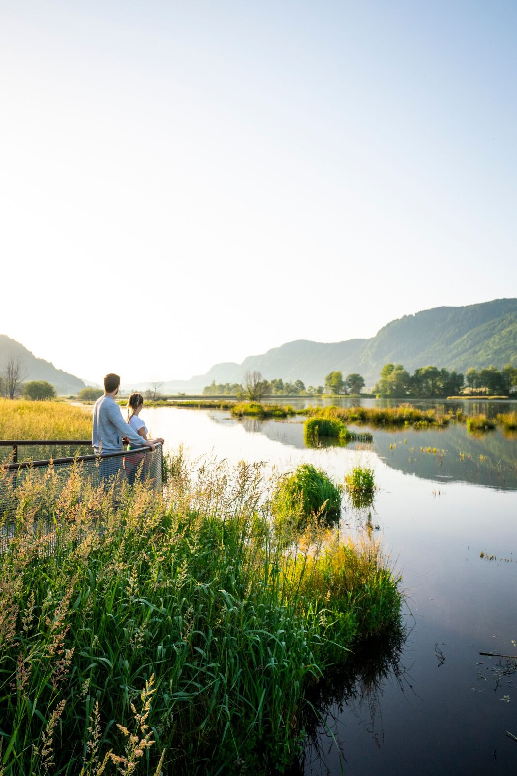
The Carinthian Slow Trails help hikers to experience the 7 typologies of the landscapes around the Carinthian lakes. The Slow Trails focus on slow motion rather than high speed and offer relaxed & leisurely walking. They are easy to walk in terms of technique and difficulty. At the same time they are very well maintained high quality paths and lead to places with special scenic beauty which allow you to experience the Carinthian lakes.
- Difficoltà
-
facile
- Valutazione
-
- Percorso
-
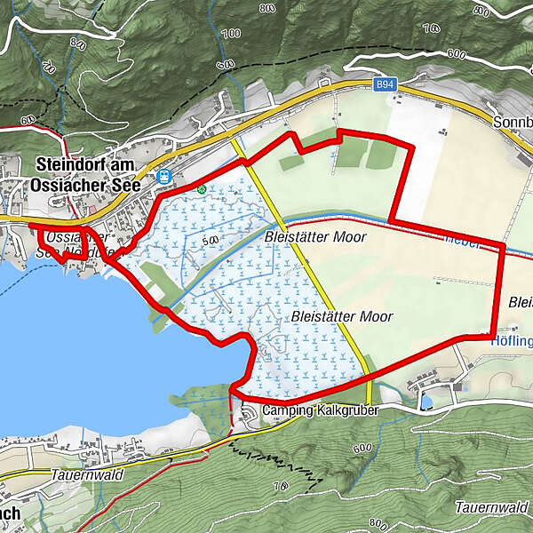
Schiffstation Steindorf0,2 kmSteindorf am Ossiacher See (510 m)0,6 kmSteindorf am Ossiacher See (510 m)6,8 km
- La stagione migliore
-
genfebmaraprmaggiulugagosetottnovdic
- Punto più alto
- 509 m
- Destinazione
-
Gasthof Laggner
- Profilo altimetrico
-


- Autore
-
Il tour Slow Trail Bleistätter Moor è utilizzato da outdooractive.com fornito.
Tutte le recensioni
Ramin Hazrati
30. Mar. 2024
Natur pur
Schön flach und leicht zu bewandern und schöne Flora und Fauna zu entdecken. Schöne Plätze zum entspannen und genießen sowie Aussichtsplattformen um tiefer in das Moore zu Blicken😄
Trovi utile questa recensione
Tu e 1 persona ha trovato questa recensione utile
Tu e Le persone trovano questa recensione utile
1 persona ha trovato questa recensione utile
Le persone trovano questa recensione utile
|
GPS Downloads


Info generali
Flora
Fauna
Altri tour nelle regioni