Hunsrück-Radweg (Hunsrueck Cycle Route)

Percorso ciclabile

© Hunsrück-Touristik GmbH - Fabiulous Pics

- Descrizione rapida
-
Away from the popular river cycle paths and far from the crowds, the Hunsrück cycle path allows you to relax and immerse yourself in the idyllic natural surroundings.
- Difficoltà
-
difficile
- Valutazione
-
- Percorso
-
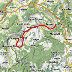
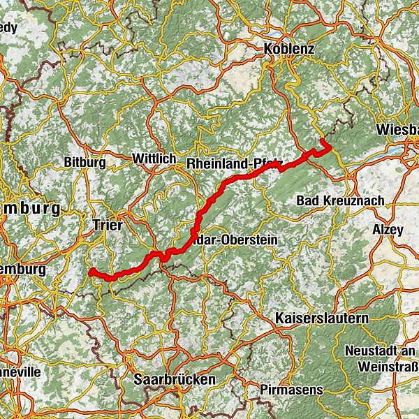
Sarrebourg (160 m)Evangelische KircheNiederleuken1,7 kmIrsch6,5 kmBerends Kapelle7,8 kmQuellfassung9,0 kmOberzerf15,2 kmNiederzerf16,8 kmDie Winzerpost17,0 kmFrommersbach18,0 kmNiederkell25,6 kmKell am See28,7 kmRestaurant Zur Post28,9 kmBrasserie Typisch29,1 kmReinsfeld36,1 kmRhodos43,8 kmHermeskeil43,9 kmSankt Martinus44,1 kmAbtei48,4 kmThiergarten50,6 kmErbeskopf (816 m)63,1 kmHängende Birke65,4 km2tHeimat77,3 kmSankt Anna78,5 kmMorbach78,7 kmSankt Paulinus81,3 kmBischofsdhron81,4 kmHinzerath85,1 kmAlte Kirche Sankt Johannes der Täufer85,2 kmHochscheid91,3 kmEvangelische Kirche91,3 kmHorbruch93,6 kmScherers Landgasthof93,6 kmHirschfeld (Hunsrück)94,7 kmWahlenau95,6 kmBüchenbeuren99,0 kmSohren102,1 kmSt. Michael110,3 kmKirchberg110,5 kmNickweiler116,6 kmNannhausen118,7 kmSchmiedel119,9 kmStephanskirche123,2 kmSimmern123,3 kmRiesweiler127,5 kmArgenthal131,0 kmLacky's Pizzeria131,0 kmEllern (Hunsrück)135,0 kmIndia House139,8 kmRheinböllen140,3 kmDichtelbach142,2 kmHirtenborn146,4 kmZur Traube151,5 kmW. Böhler151,5 kmChargéplatz151,5 kmOberheimbach151,6 kmNiederheimbach153,7 kmMariä Himmelfahrt153,9 kmFähre Niederheimbach - Lorch154,2 kmNiederheimbach154,3 kmLorch155,0 kmRheindiebach155,8 kmSt. Nikolaus158,0 kmBacharach158,4 km
- La stagione migliore
-
genfebmaraprmaggiulugagosetottnovdic
- Punto più alto
- 810 m
- Destinazione
-
Bacharach (Rhine)
- Profilo altimetrico
-
 © outdooractive.com
-

-
AutoreIl tour Hunsrück-Radweg (Hunsrueck Cycle Route) è utilizzato da outdooractive.com fornito.
GPS Downloads


Info generali
Culturale/Storico
Flora
Promettente
Altri tour nelle regioni