© Mittelburgenland-Rosalia - Petra Aminger

- Descrizione rapida
-
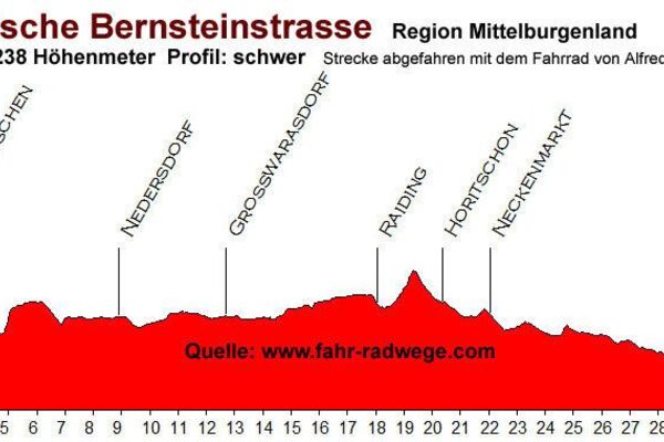
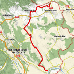
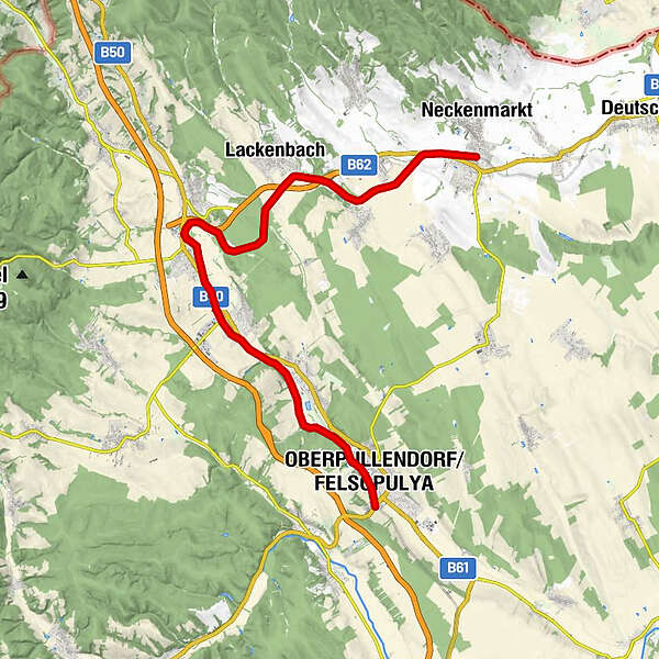
Hier kann man vom Fahrrad auf die Draisine wechseln und das Sonnenland Mittelburgenland auf den Gleisen einer aufgelassenen Bahnlinie erkunden. Die Strecke verläuft zwischen Neckenmarkt/Horitschon und Oberpullendorf und ist ca. 23 km lang. Gefahren wird den ganzen Tag in nur eine Richtung. Die reine Fahrzeit beträgt ca. 2,5 Stunden. Allerdings sollte man 3-4 Stunden für die Draisinentour einplanen, um sich auf den 3 bewirteten Stationen entlang der Strecke auch eine verdiente Pause zu gönnen.
- Difficoltà
-
facile
- Valutazione
-
- Percorso
-
Oberpullendorf0,4 kmOberpullendorf/Felsőpulya0,9 kmStoob Süd1,8 kmStoob4,4 kmMagazin4,7 kmStoob4,7 kmNeutal7,6 kmMarkt St. Martin9,5 kmMarkt Sankt Martin9,7 kmLackenbach16,7 kmRaiding-Lackendorf20,0 kmNeckenmarkt-Horitschon22,5 kmHoritschon22,5 km
- La stagione migliore
-
genfebmaraprmaggiulugagosetottnovdic
- Punto più alto
- 327 m
- Destinazione
-
Horitschon/Oberpullendorf
- Profilo altimetrico
-


- Autore
-
Il tour Sonnenland Draisinentour è utilizzato da outdooractive.com fornito.
GPS Downloads


Info generali
Punto di ristoro
Altri tour nelle regioni
-
Wiener Alpen
225
-
Sonnenland Mittelburgenland
79
-
Stoob
34