

© Fredy Joss

- Descrizione rapida
-
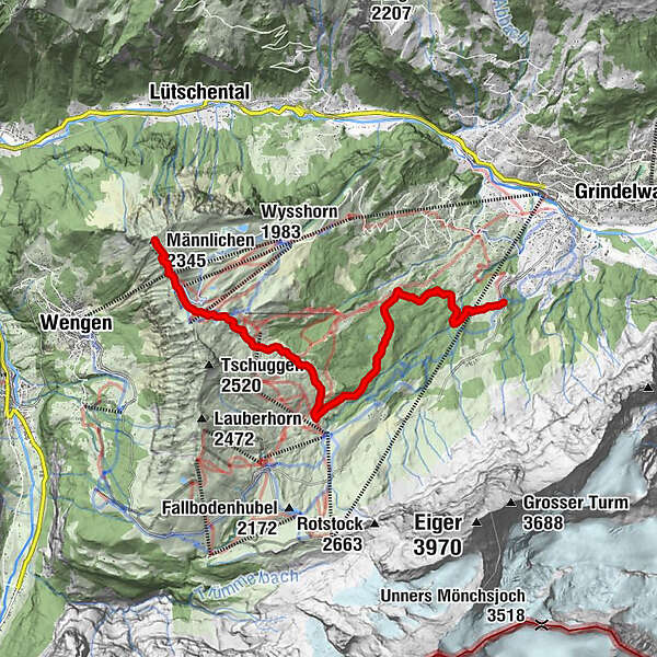
Auch in der Region Grindelwald–Männlichen gibt es noch wenig besuchte Wege, auf denen man hinsichtlich Schönheit und Panorama keine Abstriche machen muss. Einer dieser Wege führt vom Männlichen durch den Itramenwald nach Brandegg.
- Difficoltà
-
intermedio
- Valutazione
-
- Percorso
-
Berghaus Männlichen0,1 kmMännlichen (2.230 m)0,3 kmMossenegg0,8 kmMännlichen (2.345 m)0,8 kmMännlichen1,9 kmMännlichen (2.225 m)2,0 kmBrandegg-Bidemmeder11,0 kmRestaurant Brandegg11,3 kmBrandegg (1.333 m)11,3 km
- La stagione migliore
-
genfebmaraprmaggiulugagosetottnovdic
- Punto più alto
- 2.328 m
- Destinazione
-
Brandegg, Station
- Profilo altimetrico
-
 © outdooractive.com

-

-
AutoreIl tour Knorrige Arven und eisige Gipfel è utilizzato da outdooractive.com fornito.
GPS Downloads


Info generali
Punto di ristoro
Promettente
Altri tour nelle regioni
-
Aletsch Arena
1471
-
Jungfrau Region
1007
-
Grindelwald - Männlichen
466


