


Dati percorsi
7,25km
1.040
- 1.406m
386hm
377hm
02:03h
- Descrizione rapida
-
Kurze Rundtour auf den Napfgipfel
- Difficoltà
-
intermedio
- Valutazione
-
- Percorso
-
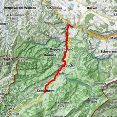
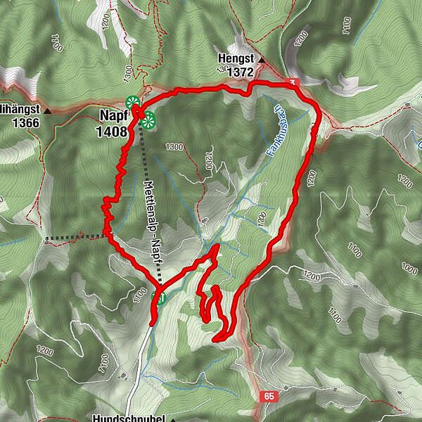
Gruppenunterkunft Mettlenalp0,1 kmHinter Mettlen0,1 kmMettlenalp0,1 kmNapf (1.408 m)2,0 kmNapf2,1 kmStächelegg3,3 kmMettlenalp6,9 kmHinter Mettlen6,9 kmGruppenunterkunft Mettlenalp6,9 km
- Punto più alto
- 1.406 m
GPS Downloads


Altri tour nelle regioni
-
Obwalden
2027
-
UNESCO Biosphäre Entlebuch
633
-
Luthern
146