Dati percorsi
11,67km
1.077 - 2.037m
Distanz
915hm
941hm
L'ascesa
04:46h
 
Durata
Descrizione rapida

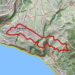
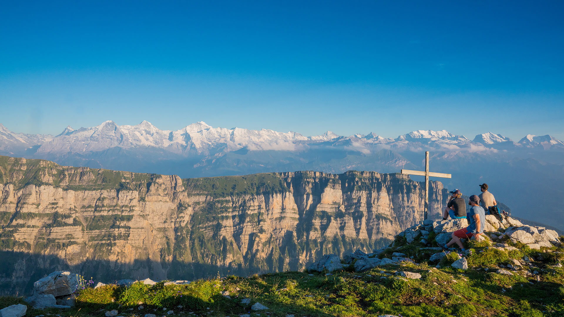
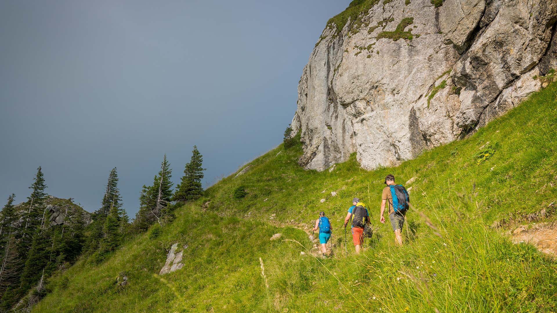
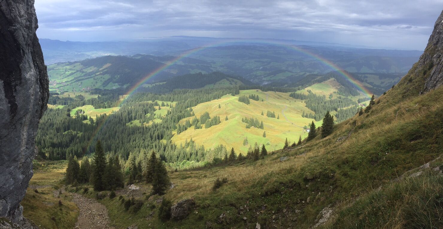
This route takes hikers through a hilly landscape of forests and alpine meadows up to the steep limestone cliffs of the Sigriswiler Rothorn mountain chain. Here the view stretches far and wide to the Jura and to the many fourthousand metre peaks of the Bernese Oberland.

Difficoltà
intermedio
Valutazione
Tecnica
Forma fisica
Panorama
Avventura / Esperienza
Percorso
Schwanden
Schafloch
4,0 km
Schwanden
11,6 km

La stagione migliore
gen
feb
mar
apr
mag
giu
lug
ago
set
ott
nov
dic
Punto più alto
2.037 m
Destinazione

Schwanden Säge

Profilo altimetrico
© outdooractive.com

Autore
Il tour Sigriswiler Rothorn è utilizzato da outdooractive.com fornito.

Valutazione complessiva

5

0

%

4

0

%

3

0

%

2

0

%

1

0

%

Errore
Si è verificato un errore. Si prega di riprovare.
Grazie per la vostra recensione

La valutazione è stata cancellata

GPS Downloads
  • GPX GPS Exchange Format (XML)
  • KML Google Earth, Google Maps
Codici di download QR per telefoni cellulari

Info generali

Suggerimento
Promettente
Altri tour nelle regioni

Tour popolari della zona

Sigriswil: Panoramaweg Chumewäldli Rotbühl

facile Escursionismo
5,91km | 113hm | 01:40h

Sieben Hengste

difficile Escursionismo
13,71km | 985hm | 05:05h

Saxeten - Rengglipass - Morgenberghorn - Brunnihütte - Suld Pochten...

intermedio Escursionismo
11,2km | 1135hm | 04:30h

Niederhorn-Burgfeldstand-Gemmenalphorn-Justistal-Beatenberg

intermedio Escursionismo
18,12km | 1143hm | 05:30h