- Difficoltà
-
facile
- Valutazione
-
- Percorso
-
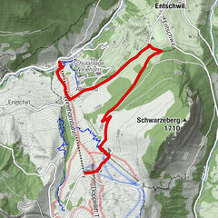
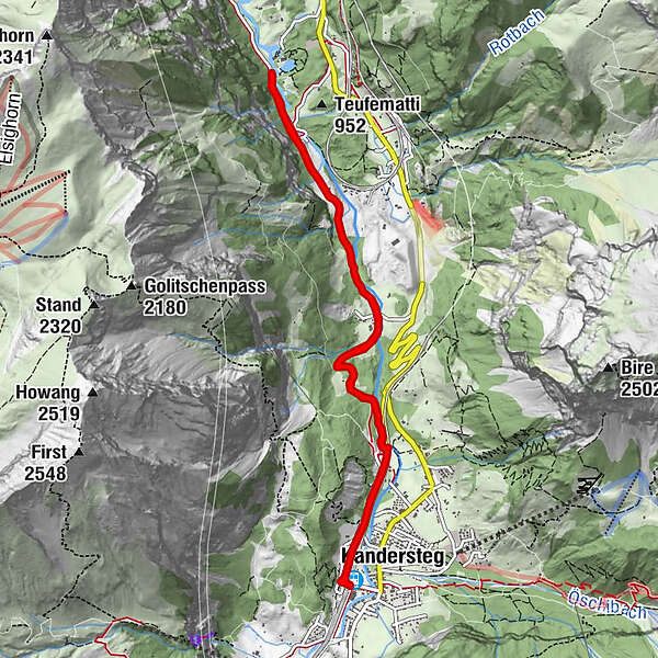
Kandersteg (1.176 m)0,0 kmKandersteg (1.174 m)0,5 kmUnderem Büel2,8 kmHundsprung4,0 kmI de Schwendweidlene4,8 kmHundsprung6,2 kmUnderem Büel7,5 kmKandersteg (1.174 m)9,5 kmKandersteg (1.176 m)10,1 km
- La stagione migliore
-
genfebmaraprmaggiulugagosetottnovdic
- Punto più alto
- 1.176 m
- Destinazione
-
Kandersteg train station
- Profilo altimetrico
-
 © outdooractive.com
-

-
AutoreIl tour Blausee Biketour è utilizzato da outdooractive.com fornito.
GPS Downloads


Altri tour nelle regioni