© Sonnenalp Resort • Spa • Golf - Sonnenalp Resort
Dati percorsi
5,22km
870
- 1.149m
392hm
259hm
02:03h
- Descrizione rapida
-
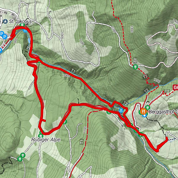
Am Gaisalpbach entlang wandert man auf Pfaden, Felsstufen und steilen Brücken zur Richteralpe bergauf. Bergab kann man die asphaltierte Straße nehmen.
- Difficoltà
-
intermedio
- Valutazione
-
- Percorso
-
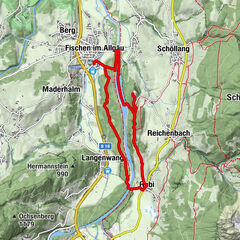
Reichenbach0,1 kmGaisalpkapelle2,4 kmReichenbach4,1 km
- La stagione migliore
-
genfebmaraprmaggiulugagosetottnovdic
- Punto più alto
- 1.149 m
- Destinazione
-
Reichenbach
- Profilo altimetrico
-
 © outdooractive.com
-

-
AutoreIl tour Gaisalptobel è utilizzato da outdooractive.com fornito.
GPS Downloads


Info generali
Punto di ristoro
Promettente
Altri tour nelle regioni
-
Allgäu
2357
-
Alpsee-Grünten
1694
-
Oberstdorf / Nebelhorn
440