Dati percorsi
7,91km
617
- 824m
221hm
211hm
03:00h
- Descrizione rapida
-
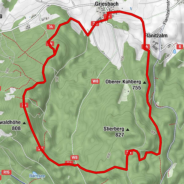
Startpunkt und Streckenverlauf:
Dorfplatz Griesbach – Posthalterkapelle - Leitenwald – Florianskapelle - Stierberg – Flanitzalm – Dorfplatz Griesbach
Markierung: rot 24 - Difficoltà
-
intermedio
- Valutazione
-
- Punto di partenza
-
Dorfplatz Griesbach
- Percorso
-
GriesbachFlorianskapelle2,6 kmLeitenwaldhöhe (808 m)2,8 kmOberer Kühberg (755 m)6,4 kmFlanitzalm7,0 kmGriesbach7,7 km
- Punto più alto
- 824 m
- Destinazione
-
Dorfplatz Griesbach
- Informazioni
-
Wanderflyer kostenlos in der Touristinfo Zwiesel erhältlich
- Cartine
-
Wanderkarte "Zwieseler Winkel" - mit GUTI Gästekarte kostenlos in der Touristinfo Zwiesel erhältlich
GPS Downloads


Altri tour nelle regioni
-
Bayerischer Wald
520
-
Zwiesel
209