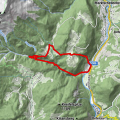
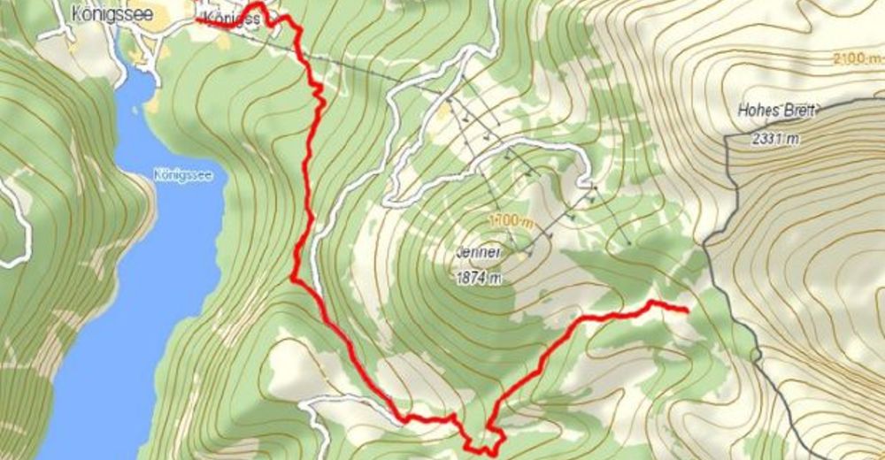
Dati percorsi
7,53km
621 - 1.677m
Distanz
1.056hm
L'ascesa
05:30h
 
Durata
Valutazione
Tecnica
Forma fisica
Panorama
Avventura / Esperienza
Punto di partenza

Parkplatz Königssee

Percorso
Königssee
Königsbachalm
4,2 km
Schneibsteinhaus
7,4 km


La stagione migliore
gen
feb
mar
apr
mag
giu
lug
ago
set
ott
nov
dic
Punto più alto
1.677 m

Riposo/Ritiro

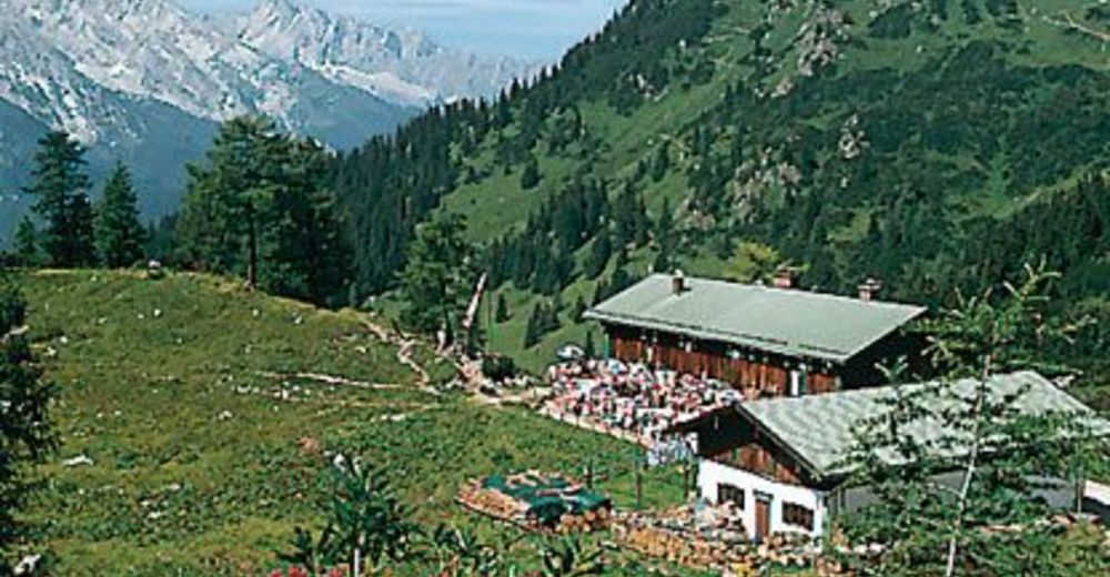
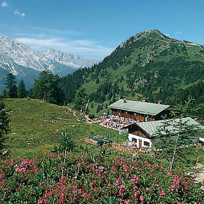
Königsbachalm, Schneibsteinhaus, Car-von-Stahlhaus


4,3
Valutazione complessiva

5

50

%

4

25

%

3

25

%

2

0

%

1

0

%

GPS Downloads
  • GPX GPS Exchange Format (XML)
  • KML Google Earth, Google Maps
Codici di download QR per telefoni cellulari

Condizioni dei sentieri

Asfalto
Ghiaia (70%)
Prato
Foresta (20%)
Roccia (10%)
Esposta
Altri tour nelle regioni

Tour popolari della zona

Summit tour Taghaube

difficile Escursionismo
6,25km | 768hm | 03:00h

Almbachklamm Rundweg Gatterlweg

intermedio Escursionismo
7,51km | 366hm | 04:43h

Hoher Göll Normalweg über Purtschellerhaus

intermedio Escursionismo
4,35km | 1155hm | 07:00h

Hintersee Rundwanderweg

facile Escursionismo
5,1km | 9hm | 01:20h