© Tourenportal Berchtesgadener Land - Bergerlebnis Berchtesgaden
Dati percorsi
9,22km
565
- 1.151m
696hm
709hm
02:17h
- Descrizione rapida
-
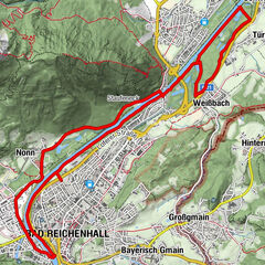
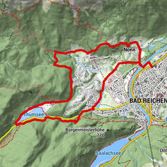
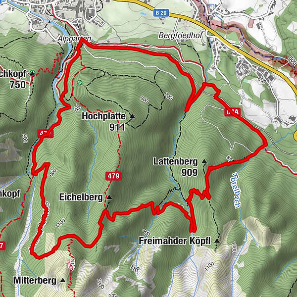
9,5 km, 820 Höhenmeter, Ausgangspunkt: Wanderzentrum Bayerisch Gmain
- Difficoltà
-
difficile
- Valutazione
-
- Percorso
-
Bayerisch GmainBad Reichenhall (473 m)0,0 kmBad Reichenhall (473 m)9,2 kmBayerisch Gmain9,2 km
- La stagione migliore
-
genfebmaraprmaggiulugagosetottnovdic
- Punto più alto
- 1.151 m
- Destinazione
-
Wanderzentrum Bayerisch Gmain
- Profilo altimetrico
-
 © outdooractive.com
-

-
AutoreIl tour Lattengebirgs-Querung è utilizzato da outdooractive.com fornito.
GPS Downloads


Info generali
Promettente
Altri tour nelle regioni