BLKB-Wanderung Galms- Huppergruben

Logo BLKB-Wanderung Galms- Huppergruben
Dati percorsi
6,58km
334 - 546m
Distanz
230hm
212hm
L'ascesa
01:58h
 
Durata
Descrizione rapida

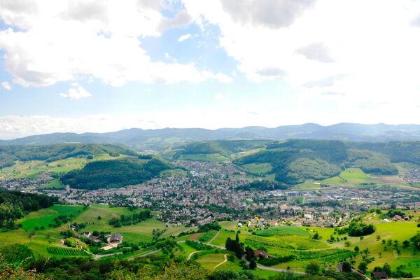
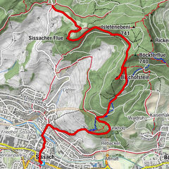
Die Wanderung führt vom Liestaler Altmarkt über den Galms und die Landschachen ins Gebiet der Huppergruben.

Percorso
Liestal (327 m)
Lausen
6,5 km

Punto più alto
546 m
Destinazione

Lausen Bahnhof

Profilo altimetrico
© outdooractive.com

Autore
Il tour BLKB-Wanderung Galms- Huppergruben è utilizzato da outdooractive.com fornito.

Valutazione complessiva

5

0

%

4

0

%

3

0

%

2

0

%

1

0

%

Errore
Si è verificato un errore. Si prega di riprovare.
Grazie per la vostra recensione

La valutazione è stata cancellata

GPS Downloads
  • GPX GPS Exchange Format (XML)
  • KML Google Earth, Google Maps
Codici di download QR per telefoni cellulari
Altri tour nelle regioni

Tour popolari della zona

Sissacherfluh - Ruine Bischofstein

facile Escursionismo
5,87km | 125hm | 01:50h

Baselbieter Chirsiweg

intermedio Escursionismo
10,65km | 294hm | 03:02h

Belchenflue Rundwanderung

facile Escursionismo
9,06km | 408hm | 02:59h

Rundwanderung Chaltbrunnental - Chastelbach

intermedio Escursionismo
7,93km | 195hm | 02:25h