© Hochschwarzwald Tourismus GmbH

- Descrizione rapida
-
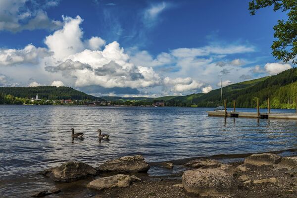
Diese Strecke ist eine idyllische Wanderung mit wunderschöner Aussicht vom Schorrmättle.
- Difficoltà
-
facile
- Valutazione
-
- La stagione migliore
-
genfebmaraprmaggiulugagosetottnovdic
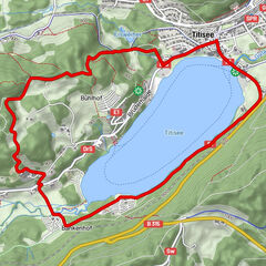
- Punto più alto
- 1.069 m
- Profilo altimetrico
-
 © outdooractive.com


- Autore
-
Il tour St. Blasien Loipenhütte è utilizzato da outdooractive.com fornito.
GPS Downloads


Info generali
Clima curativo
Flora
Promettente
Altri tour nelle regioni
-
Schwarzwald
1846
-
Hochschwarzwald
1172
-
Dachsberg Hotzenwald
221