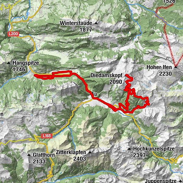
Mellau - Schoppernau - Neuhornbach - Diedamskopf - Mellau

Mountainbike

Dati percorsi
50,33km
685
- 2.056m
1.693hm
1.700hm
04:00h
- Descrizione rapida
-
Mountainbikeroute von Mellau nach Schoppernau, über Neuhornbach auf den Diedamskopf und auf der Vorderseite zurück nach Schoppernau und wieder nach Mellau
- Difficoltà
-
intermedio
- Valutazione
-
- Punto di partenza
-
Mellau Bergbahnen
- Percorso
-
HinterbündtTanna0,4 kmEnge1,4 kmHirschau2,9 kmSchnepfau4,8 kmAu (800 m)9,2 kmLisse9,2 kmSägerstuben10,3 kmNeugrund10,3 kmRehmen10,5 kmSchoppernau (852 m)12,8 kmHotel Gasthof Adler13,1 kmTresoli13,2 kmÜntschele14,4 kmNeuhornbach Alpe18,6 kmNeuhornbachhaus (1.700 m)19,1 kmBreitenalpe21,1 kmAlpe Mitteldiedams23,5 kmPanoramarestaurant27,8 kmDiedamskopf (2.090 m)28,0 kmOberdiedamsalpe29,8 kmAlpe Mitteldiedams32,4 kmZum Fraaanz Restaurant38,0 kmSt. Philippus & Jakobus38,1 kmSchoppernau (852 m)38,5 kmHotel Restaurant Schiff39,9 kmRehmen40,4 kmSägerstuben40,8 kmNeugrund40,8 kmAu (800 m)41,8 kmLisse41,8 kmBühlenvorsäß45,1 kmSchnepfau45,7 kmBrand48,9 km
- La stagione migliore
-
genfebmaraprmaggiulugagosetottnovdic
- Punto più alto
- 2.056 m
- Destinazione
-
Mellau Bergbahnen
- Riposo/Ritiro
-
Diedamskopf Bergstation
GPS Downloads


Percorsi
Asfalto
(40%)
Ghiaia
(60%)
Foresta
Vie di montagna
Singletrail
Trial
Traffico
Altri tour nelle regioni
-
Bregenzerwald
233
-
Diedamskopf
102
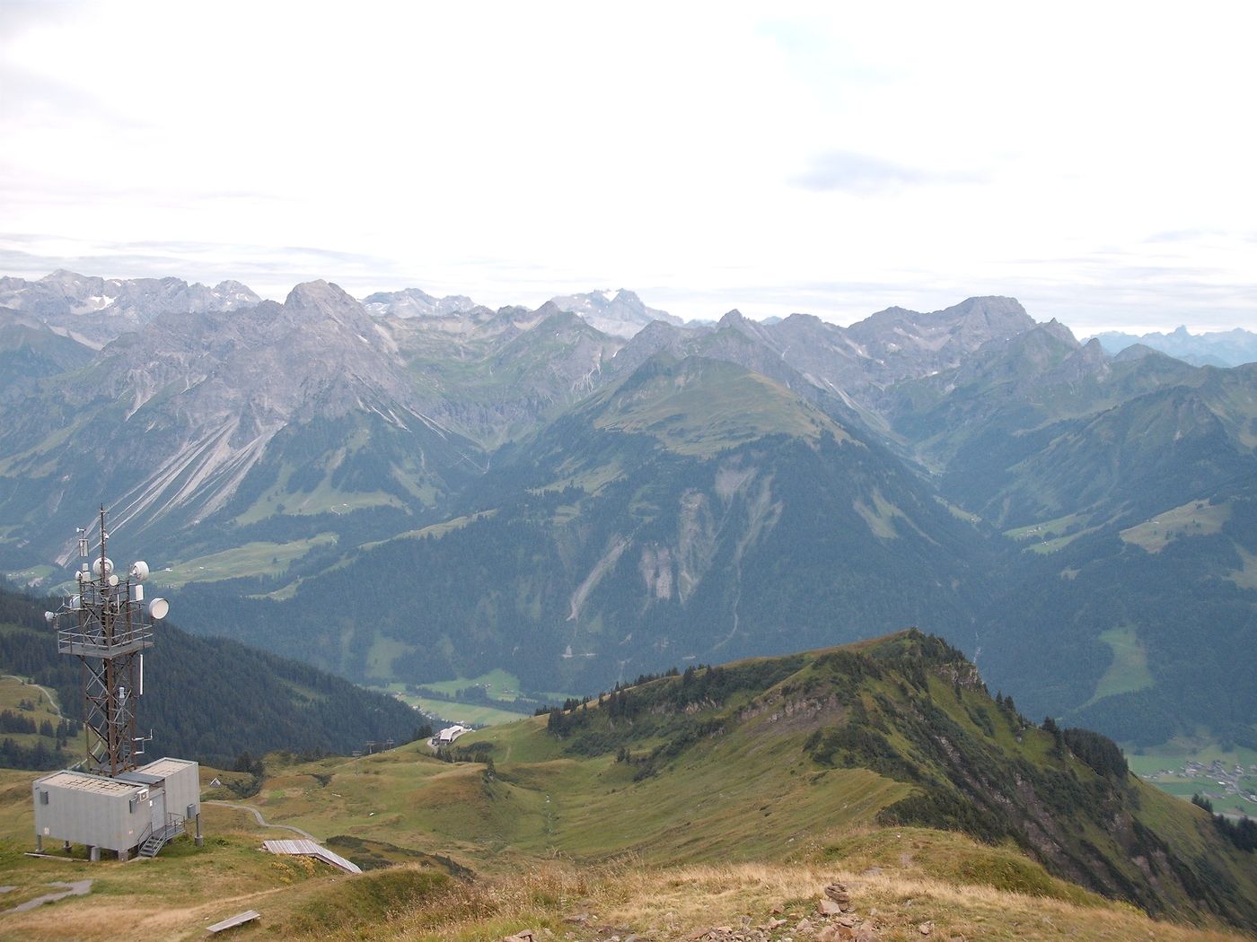
 Lech Zuers Tourismus by Hanno Mackowitz")