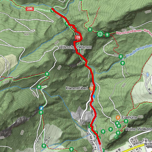
Dati percorsi
1,52km
671 - 843m
Distanz
200hm
200hm
L'ascesa
01:00h
 
Durata
Difficoltà
facile
Valutazione
Tecnica
Forma fisica
Panorama
Avventura / Esperienza
Punto di partenza

Parkplatz Wörschachklamm

Percorso
Wörschach
Klammstüberl
0,5 km


La stagione migliore
gen
feb
mar
apr
mag
giu
lug
ago
set
ott
nov
dic
Punto più alto
843 m

Riposo/Ritiro

Almausschank Oberkogler Lehen (bei Variante: Klamm-Aussichtsplattform-Burgruine)

Cartine

Tourimusverband Bergregion Grimming


5,0
Valutazione complessiva

5

100

%

4

0

%

3

0

%

2

0

%

1

0

%

GPS Downloads
  • GPX GPS Exchange Format (XML)
  • KML Google Earth, Google Maps
Codici di download QR per telefoni cellulari

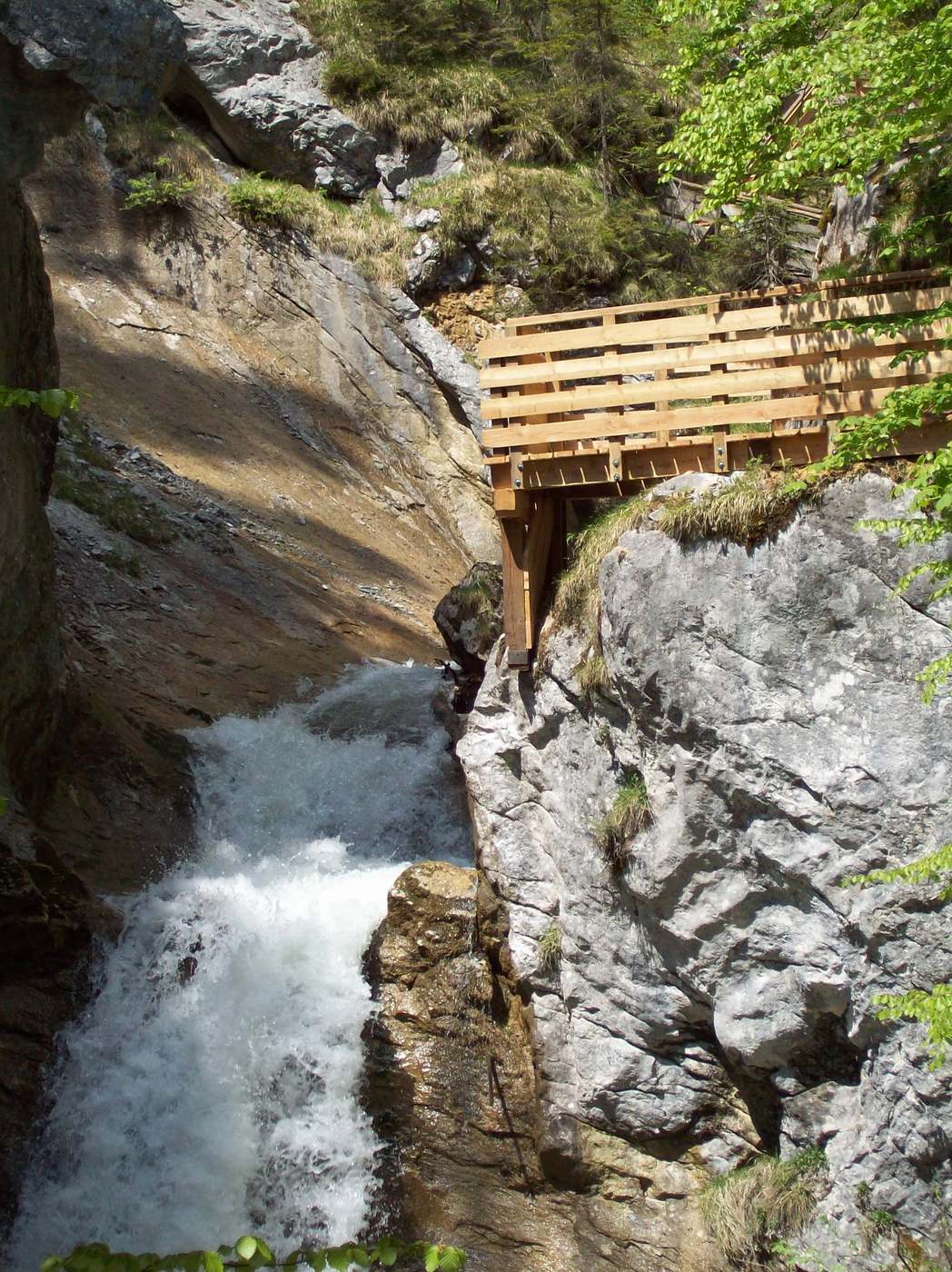
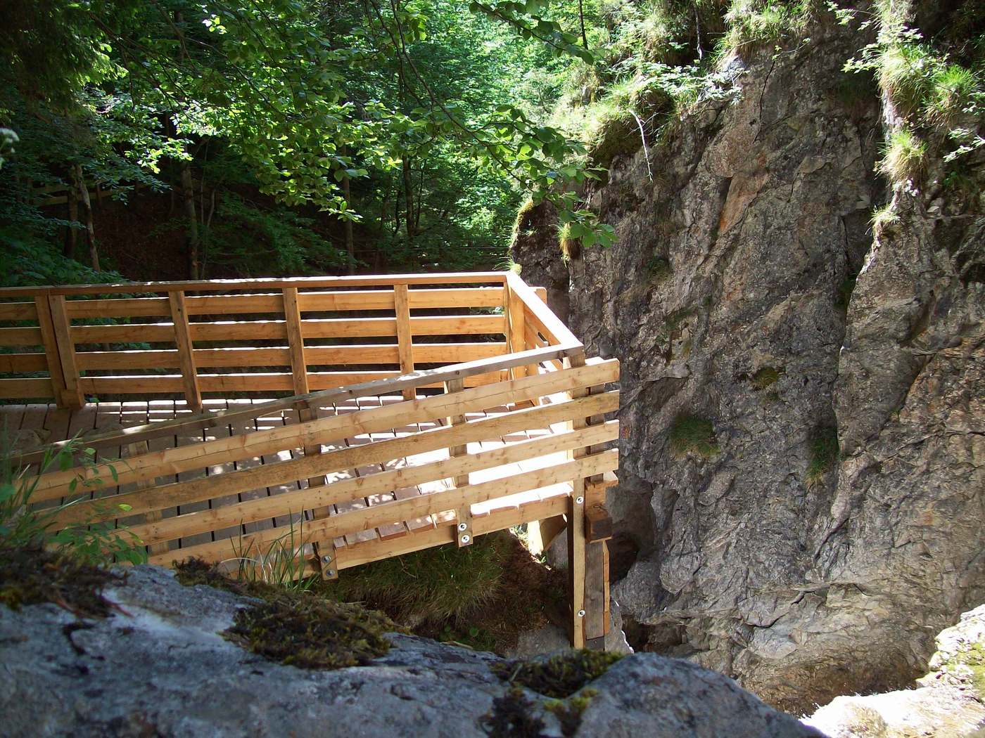
Condizioni dei sentieri

Asfalto
Ghiaia
Prato
Foresta
Roccia
Esposta
Altri tour nelle regioni

Tour popolari della zona

Dolomitensteig

difficile Escursionismo
9,29km | 718hm | 05:00h

Hinterstoder - Großer Priel

difficile Escursionismo
10,69km | 1993hm | 09:30h

Gleinkersee - Dümlerhütte

intermedio Escursionismo
7,2km | 650hm | 03:15h

Schneiderberg im Almtal

intermedio Escursionismo
7,97km | 569hm | 02:49h