© Gemeinde St. Margareten
Dati percorsi
6,24km
452
- 1.575m
1.102hm
1.102hm
06:30h
- Descrizione rapida
-
Schöne Wanderung mit tollen Ausblicken auf Ferlach und das Rosental.
- Difficoltà
-
intermedio
- Valutazione
-
- Punto di partenza
-
Gasthof "Schneerose" Ogris
- Percorso
-
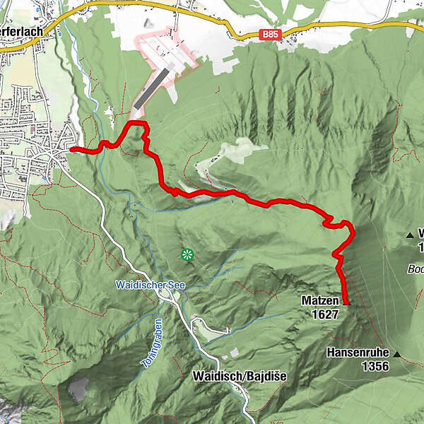
Jaklin0,9 kmRauth3,1 kmAnnakappelle5,6 kmMatzen (1.627 m)6,2 km
- La stagione migliore
-
genfebmaraprmaggiulugagosetottnovdic
- Punto più alto
- 1.575 m
- Riposo/Ritiro
-
Zahlreiche Gasthöfe in Ferlach Umgebung,
www.carnica-rosental.at/tourismus_de/... - Cartine
-
WK 234 freytag & berndt

GPS Downloads


Condizioni dei sentieri
Asfalto
Ghiaia
Prato
Foresta
Roccia
Esposta
Altri tour nelle regioni
-
Klagenfurt und Umgebung
1539
-
Ferlach
338